Ciclovia del Secchia
") This is a copybook itinerary. It includes a sensational start through the historic city centre of Modena (the wonderful Piazza Grande is a UNESCO World Heritage Site), an approaching route along bike lanes or small roads with very little traffic, a possible detour (to Campogalliano), and a destination of exceptional natural value: the Reserve “Detention Basin of the river Secchia.” (Riserva Naturale Orientata Cassa di espansione del fiume Secchia). This itinerary also includes Rubiera, where you can admire the ancient Ospitale, the historic city centre and the Romanesque church of San Faustino.
This is a copybook itinerary. It includes a sensational start through the historic city centre of Modena (the wonderful Piazza Grande is a UNESCO World Heritage Site), an approaching route along bike lanes or small roads with very little traffic, a possible detour (to Campogalliano), and a destination of exceptional natural value: the Reserve “Detention Basin of the river Secchia.” (Riserva Naturale Orientata Cassa di espansione del fiume Secchia). This itinerary also includes Rubiera, where you can admire the ancient Ospitale, the historic city centre and the Romanesque church of San Faustino.
Detention basins (dammed basins with 8 kilometres of perimeter and a floodable surface of about 200 hectares) were born at the end of the 70s as a best practice for “hydraulic safety” to control the extreme floods of the river Secchia. Over time they have acquired other qualities: scenic landscape views, habitat for nesting birds and, last but not least, a destination for excursions and hiking.
") From the Modena railway station you reach the Via Emilia and follow it to the west. Beyond the gates of the city you follow a path along “minor” streets until you cross the Secchia with the beautiful bridge “Barchetta”. On the opposite riverbank you can make a detour to the centre of Campogalliano or you may reach the detention basin from the Santuario della Sassola. This area offers at least three different types of environment: the typical plain forests, the reeds along the banks, and the wetlands, even with marsh vegetation. The proposed cycle route is highly representative, because it allows you to take in the whole habitat of the protected area. It consists of the complete tour of the riverbanks, pleasantly enriched with some detours and stops for contemplation, wild fauna observation and especially birdwatching, one of the main attractions of the entire reserve.
From the Modena railway station you reach the Via Emilia and follow it to the west. Beyond the gates of the city you follow a path along “minor” streets until you cross the Secchia with the beautiful bridge “Barchetta”. On the opposite riverbank you can make a detour to the centre of Campogalliano or you may reach the detention basin from the Santuario della Sassola. This area offers at least three different types of environment: the typical plain forests, the reeds along the banks, and the wetlands, even with marsh vegetation. The proposed cycle route is highly representative, because it allows you to take in the whole habitat of the protected area. It consists of the complete tour of the riverbanks, pleasantly enriched with some detours and stops for contemplation, wild fauna observation and especially birdwatching, one of the main attractions of the entire reserve.
THE OTHER CICLOVIE -->
ELEVATION PROFILE

Download the elevation profile (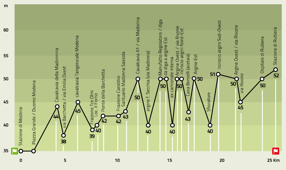 240.49 KB)
CARTOGRAPHY

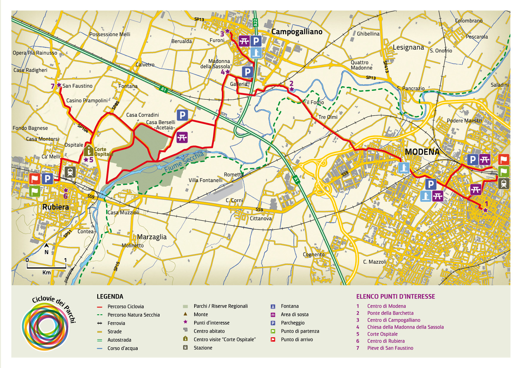 2.05 MB)