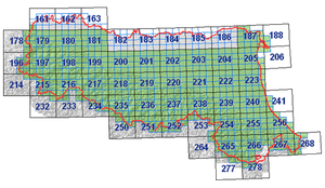
The geological cartography of Appennines, scale 1:10,000
 The survey to scale 1:10,000 is now almost complete and maps which cover the mountain and hill areas of Emilia-Romagna have been published.
The regional geological maps which have not yet been printed are already available at the Cartography Service offices for organisations, and professionals working for them, who need to consult detailed basic geological cartography for purposes of public utility.
The key to the map is generally arranged in accordance with the chronostratigraphic order; occasionally, in areas where it is not possible to reconstruct the stratigraphic succession, the order is that of the geometric sequence.
Since there are no illustrative notes, the description of the mapped units is as detailed as possible within the limitations of the space available in the margin.
The key order follows the information in RER (1990b) and CNR-CCGG (1994). Except for rare exceptions, the map and the key are accompanied by one or more geological cross-sections and tectonic and stratigraphic diagrams. The information base of the 1:10,000 geological map and the conceptual model of the relative database are described in RER (1991).
The regional reference law
Regional law 19 april 1975, n. 24 about the emilia-romagna regional cartography.
The on-line geological cartography
The Geological, Seismic and Soil Survey of Emilia-Romagna has published on the Cartographic web site, all the geological maps in scale 1:10000 of the Appennines area;
The maps and the related database can be consulted on-line: Geological cartography website (italian language site)
Areas with and without outcrops and debris cover
One special feature of the 1:10,000 geological map is the distinction between areas with outcrops and those for which the geological definition must be interpolated or extrapolated because the rocks are not exposed.
An outcrop, or outcropping zone, is an area whose physical characteristics can be studied directly because the rocks are clearly visible. The outcrops are mapped as accurately as possible.
In the printed maps the areas with outcropping rocks are represented by grey cross-hatched polygons, while in the original hand-drawn maps the outcrops are shown by brighter colours. The fact that the outcrops are represented makes any type of operation requiring observation of the outcrop much quicker and easier.
For example, if a stratigraphic section has to be studied or structural analysis of a sector is required, an initial ideal of the most suitable areas can be obtained by just looking at the map. In some cases, the size of the outcrops also provides an indication of the quality and quantity of the observations which may be made there.
The percentage of the areas with actual outcrops is also a basis for assessing the reliability of the geological map itself; the greater the density of the outcrops, the more information and data are available to the surveyor. For this reason, it is also important to map the location of any drillings or wells used for preparation of the map and available in the database.
The assessment of areas without outcrops or with cover, where the rocks are not directly exposed and where the geological data are interpolated or extrapolated from the surrounding outcrops, is equally important.
These areas are mapped on the basis of the estimates and measurements of the thicknesses and area of the covers which prevent direct observation. If the thickness and area of these covering bodies are negligible for the purposes of mapping and applications, the area is recorded as with neither outcrops nor cover; the non-outcropping rocky substrate is identified on the basis of the outcrops, in accordance with the normal surveying practice in areas without outcrops, and the area is not cross-hatched.
When thicknesses and areas are considerable and the cover is thus of geological interest, it is considered in the same way as any other deposit, in other words as a three-dimensional body and thus a continental geological unit (ground, landslide heap, fault debris, slope debris, moraine, embankments etc.).
In the case of landfills or embankments, the deposits are mapped in the same way as any other geological body and described in the key.
