The geological cartography of the map" S.Piero in Bagno", Northen Appenines
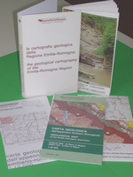
Volume "The geology of the map 265 - S. Piero in Bagno (Northern Apennines)" + Volume "The geological cartography of the Emilia-Romagna Region", all in italian and english languages
Abstract:
The geological maps of the hill and mountain areas prouced by the Geological Seismic and Soil Survey of the Emilia-Romagna Regiona are extremely detalied documents which, except for a few aspects linked to local territorial management requirements, vary little from the conventional Italian and international geological maps. Therefore tis paper will only discuss those features which distinguish these regional maps from their national and international equivalents, while the common aspects will be mentioned only briefly; for further information, specific reference will be made to the literature or other geological cartography projects. Conversely, the geological map of the plain is a new technical and scientific document. The alluvial plains are the site of most human activities, and the planning and management of the plain areas require a knowledge of the three-dimensional sedimentary bodies which make up their underground structures. This knowledge can be obtained by means of specially planned geological investigation activities, such as continuous cored boreholes, high resolution seismic analyses and penetrometric tests. Both in Italy and at an international level, experience of the geological mapping of plain areas and the relative underground formations is limited. Moreover, although they are based on similar surveying and data scquisition methods, the cartographic techniques proposed vary widley.
Publisher:
Emilia-Romagna Region - Geological Seismic and Soil Survey
Authors:
Emilia-Romagna Region - Geological Seismic and Soil Survey
Year of publication:
1994
Price:
Euro 13,00
Buy it on web:
The Bookshop of Emilia-Romagna
Informations:
phone: ++39 051-5274792
send an e-mail