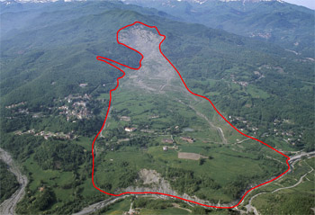
Land insabilities

Hydrogeological risk is the term commonly used to sum up the effects of a wide range of morphological processes which alter the natural landscape in a time scale ranging from relatively to extremely rapid, often with a negative or indeed disastrous impact on the local area and its inhabitants (towns, infrastructure, local businesses).
To define such phenomena as hydrogeological hazard and lump them all together under the label “degradation” is, however, inappropriate. In truth landslides (landslips and erosive processes accelerated on slopes) and fluvial processes (erosion of levees and floods) are largely natural phenomena; the same phenomena which over hundreds of thousands of years shaped the Apennines, built the Emilia-Romagna plain and channelled sediment to the Adriatic coast.
Man’s frequently-mentioned influence on these processes is not easy to quantify, although some direct changes to the natural landscape (deforestation and inappropriate use of soils) and others caused by global climate change may have intensified the processes. In an area such as the Emilian Apennines, landslides in particular, which are numerous and widespread, are mostly attributable to the natural evolution of the landscape.
The burden of cost borne by society for hydrogeological hazard is ever increasing. Cost considerations are therefore one reason why Emilia-Romagna regional authority invests in subsidence research, forecasting, prevention and mitigation activities.
- Hydrogeological hazard and the remit of the SGSS
- Landslide characteristics in Emilia-Romagna
- Historical archive if landslides
- The reactivation of ancient landslides in the Emilia-Romagna Region (Italy): risk-reduction strategies
Publications
- Coping with landslides of Emilia-Romagna
- Masterplan on Geo-environmental Hazards
- Landslide susceptibility map of the Emilia-Romagna Region, Italy - landslide relative hazard map for civil protection purposes
- Geological Degradation Map
- Photo gallery - Landslides of the Emilia-Romagna
Contact us
Geological, soil and seismic risk area
- e-mail - phone +39 051 5274792
- Marco Pizziolo - phone +39 051 527 4210
