The first geological map of Europe (1881)
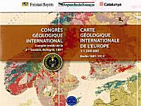
The CD contains tha first Geological map of Europe compiled by th "Commission international de Nomenclature géologique" and by the "Comité del la carte géologique de l''Europe" for the second international geological congress held in Bologna, Italy, in autumn of 1881.

The historical map, to scale 1:1.1500.000 was printed in Berlin with a print run of 100 copies and comprises 49 sheets; with the map, there is an integral copy of the Volume containing the articles of the second congress.
This is a foundamental work for modern geology as, though today it may be regarded with mild curiosity, in its day it represented an important study and research tool.
As early as the end of 19th century, the architects of modern geology drafted a geological map that trascended political and religious boundaries, thus anticipating the spirit of co-operation that binds the european union today.
The CD was distributed at the 33 IGC International Geological Congress of Oslo (august 2008) by the three regions of Emilia-Romagna, Bayern and Catalunya;
Authors
Produced and edited by Geological, seismic and soil Area of Emilia-Romagna;
Year of pubblication
2008
Information
- phone: +39 051-5274792
- send an e-mail
