In_Sea
Database on human use of the sea
Notice for users
The site is under maintenance and has been temporarily deactivated. It will be restored as soon as possible. We apologize for the inconvenience.
Within the framework of a proper coastal risk management and of the exploitation of the resources, it is fundamental to have knowledge of land uses including the marine area. For these reasons, as well as to provide the useful tools for the future planning of the maritime space, the SGSS has started the project to build a sea use geodatabase; a technical tool that allows to highlight the critical issues in the overlapping of uses and in the exploitation of resources, as well as the direct and indirect impacts on the aquatic environment.
It is a tool, closely connected to the geodatabase for the management of undersea sand deposits, that is under development.The representation of coastal and marine feature and the three-dimensional nature of water column represent a challenge for traditional geographic information systems; for this reason the SGSS is trying to readapt data type to the marine application in order to represent its dynamicity (volumetric and temporal).
As a first approximation, the data are stored on the basis of sea level involved (surface, water column, bottom and substrate) and the distance from the shore (onshore and offshore).
The themes currently found in the geodatabase have been differentiated into:
- Fishing, fishing fleet, fishing restriction (e.g.for fishing with trawl and dredge, purse seining fishing, etc); concession areas for mussel farming and aquaculture.
- Defence, military areas and related temporary and absolute restriction.
- Navigation, traffic separation scheme, inshore traffic zone, traffic lane, precautionary area and area to be avoided. We are also trying to implement it with information relating to the traffic fluxes (routes and size of the flows).
- Undersea infrastructures for exploitation of hydrocarbons : wells and platforms, cables, and pipelines, and related links for fishing and navigation constraints.
- Exploitation of undersea sand deposits and sediment discharge (link to the Management of undersea sand deposits geodatabase).
- Ports: categories, types of fleets and related constraints.
- Restrictions: areas of restriction, constraints, bans and threats to the activities that take place at sea (navigation, transit, stops, anchoring, fishing, swimming).
Developments of the use of the sea geodatabase within the European Shape project
Starting from June 2011 the General Direction for Environment and for Soil and Coast protection of Emilia-Romagna Region has been coordinating the European Shape Project (Shaping an Holistic Approach to Protect the Adriatic Environment) funded by the European Union through the IPA Adriatic 2007-2013 Cross Border Cooperation Programme. SHAPE aims at developing a multi-level and intersectoral "governance" system of the natural resources and the prevention of risks that exceed the conflicts among the uses exercised in the coastal areas and in the Adriatic Sea.
The project activity also promotes the application of the Protocol on the Integrated Coastal Zone Management in the Mediterranean and the Roadmap on maritime spatial planning in the Adriatic.
In this context, the SGSS is expanding the databases with new themes and is collaborating on the development of new verification tools to support planning choices, such as:
the synoptic representation of maritime activities and the biological, chemical and physical status of the marine environment;
the critical analysis of the overlapping of uses and conservation of the environment;
- the “technical maps of the sea”.
The thematic maps of humans uses of the sea
Starting from the above mentioned data, four thematic maps were processed that illustrate the main activities that take place at sea with particular reference to the most involved marine level (surface, water column, seabed and subsoil):
Map 1 – Exploration and exploitation of the resources – Marine subsoil
Map 2 – Undersea infrastructures and surface resources - Seabed
Map 3 – Mariculture and ecological-environmental protection areas –Water column
Map 4 – Restriction areas of human activities – Sea Surface
The themes listed above are mapped within the marine region area of reference, whose indicative limits are extended to the maritime area between the coast line and the Italy-Croatia boundary line (Continental Platform Limit. The northern and southern limits are instead represented by maps were processed that illustrate the main activities that take place at sea with particular reference to the most involved marine level (surface, water column, seabed and subsoil): broken lines which define the jurisdiction area of the Maritime Rescue Sub Centre (8° MRSC) of Ravenna , as defined in the annex 2 of the Presidential Decree n° 662 of 28/091 994 as amended by Presidential Decree n° 29 of 13/02/2007. The marine area so defined has an area extent of approximately 5040 Km².
Documents
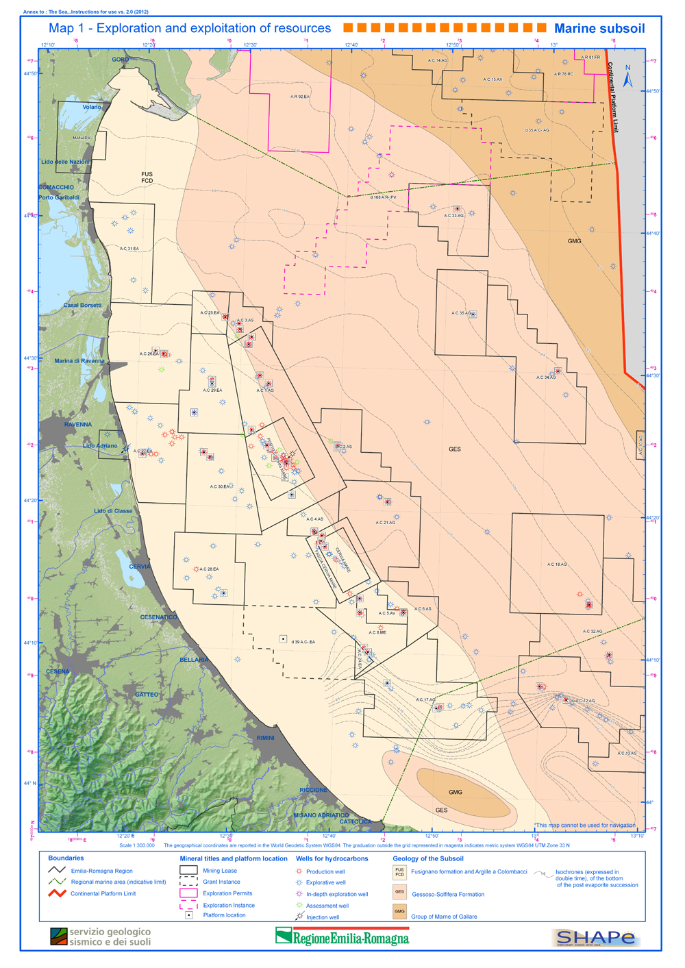
Map 1 Exploration and exploitation of the resources – Marine subsoil
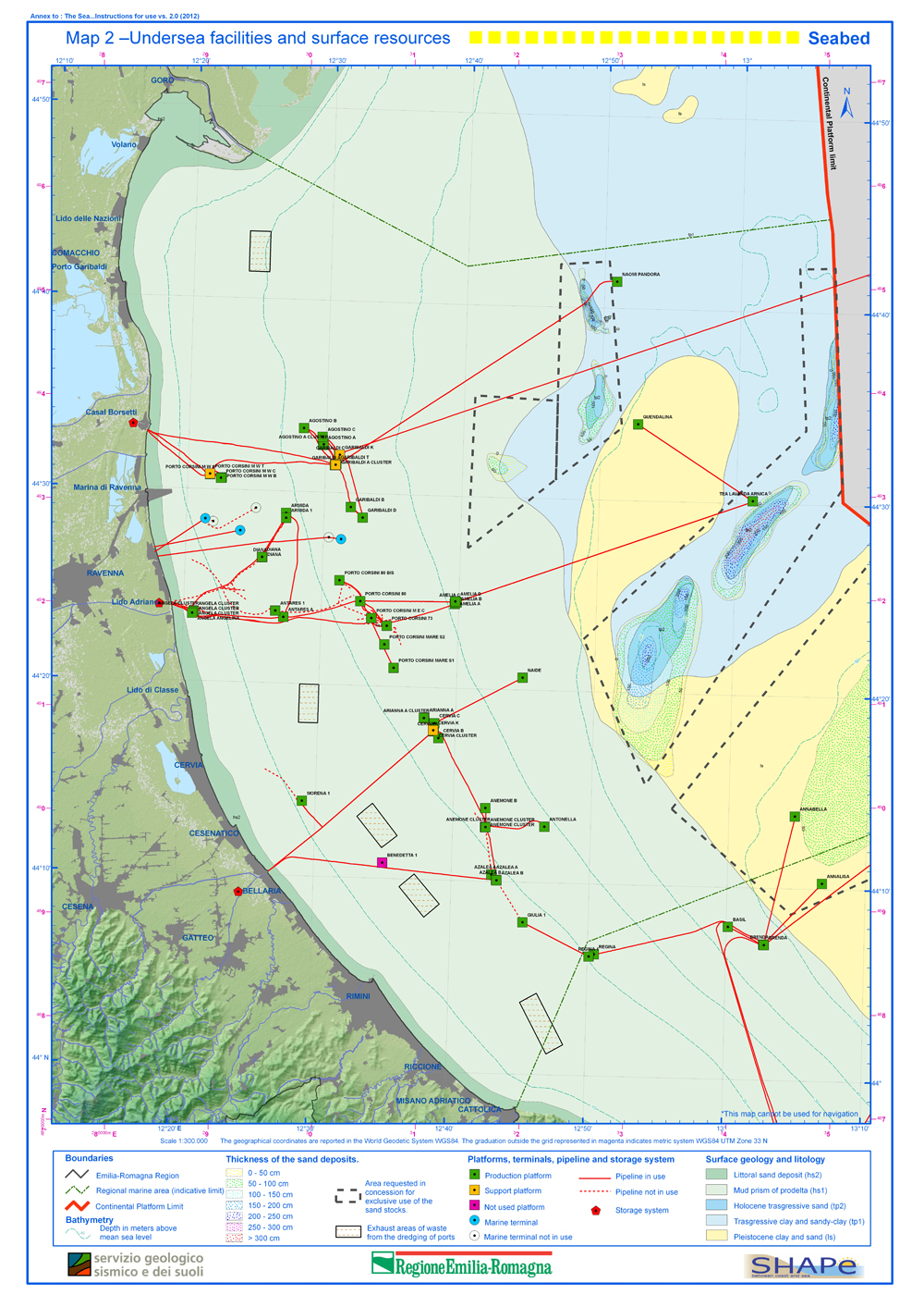
Map 2 Undersea infrastructures and surface resources - Seabed
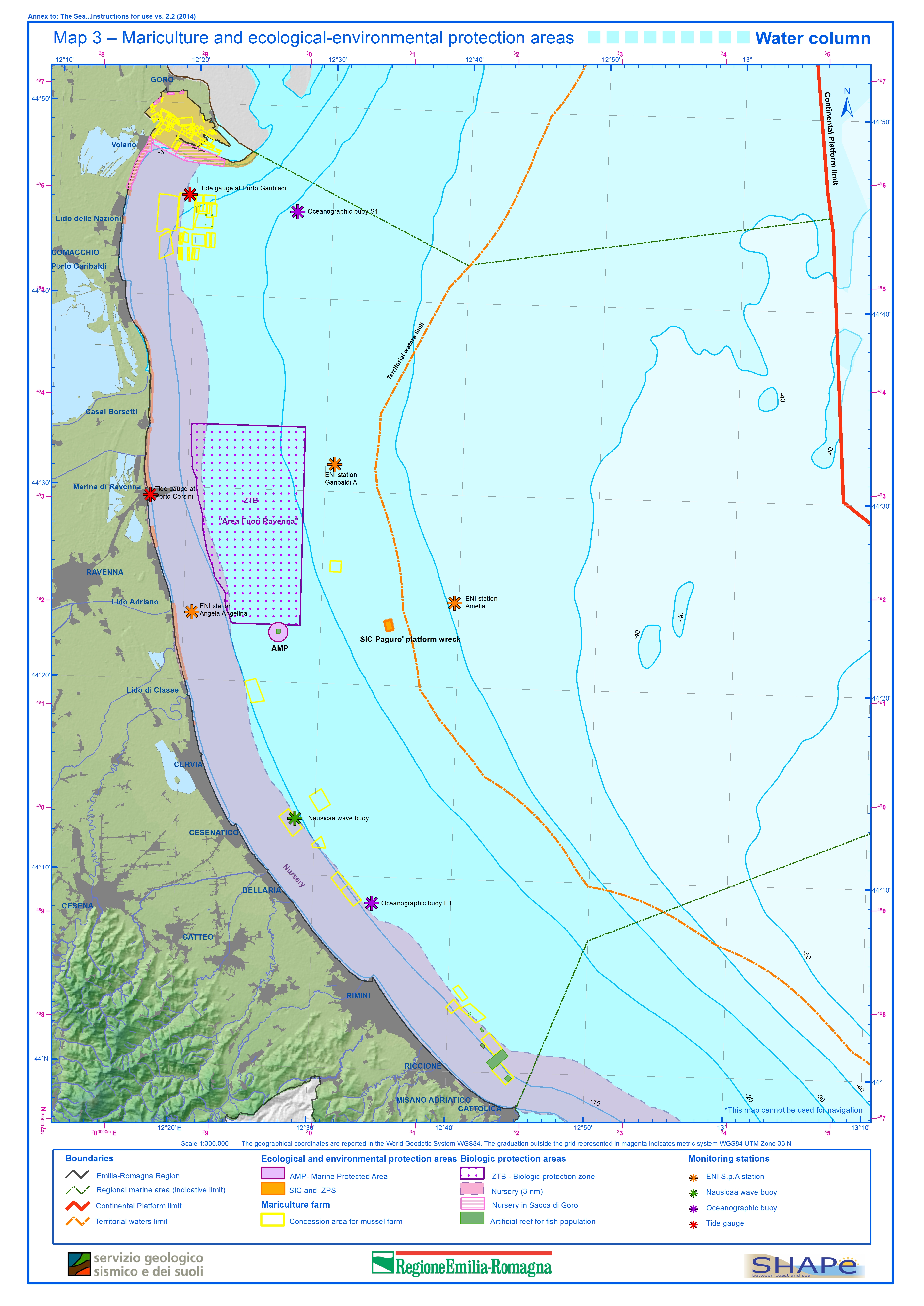
Map 3 Mariculture and ecological-environmental protection areas – Water column
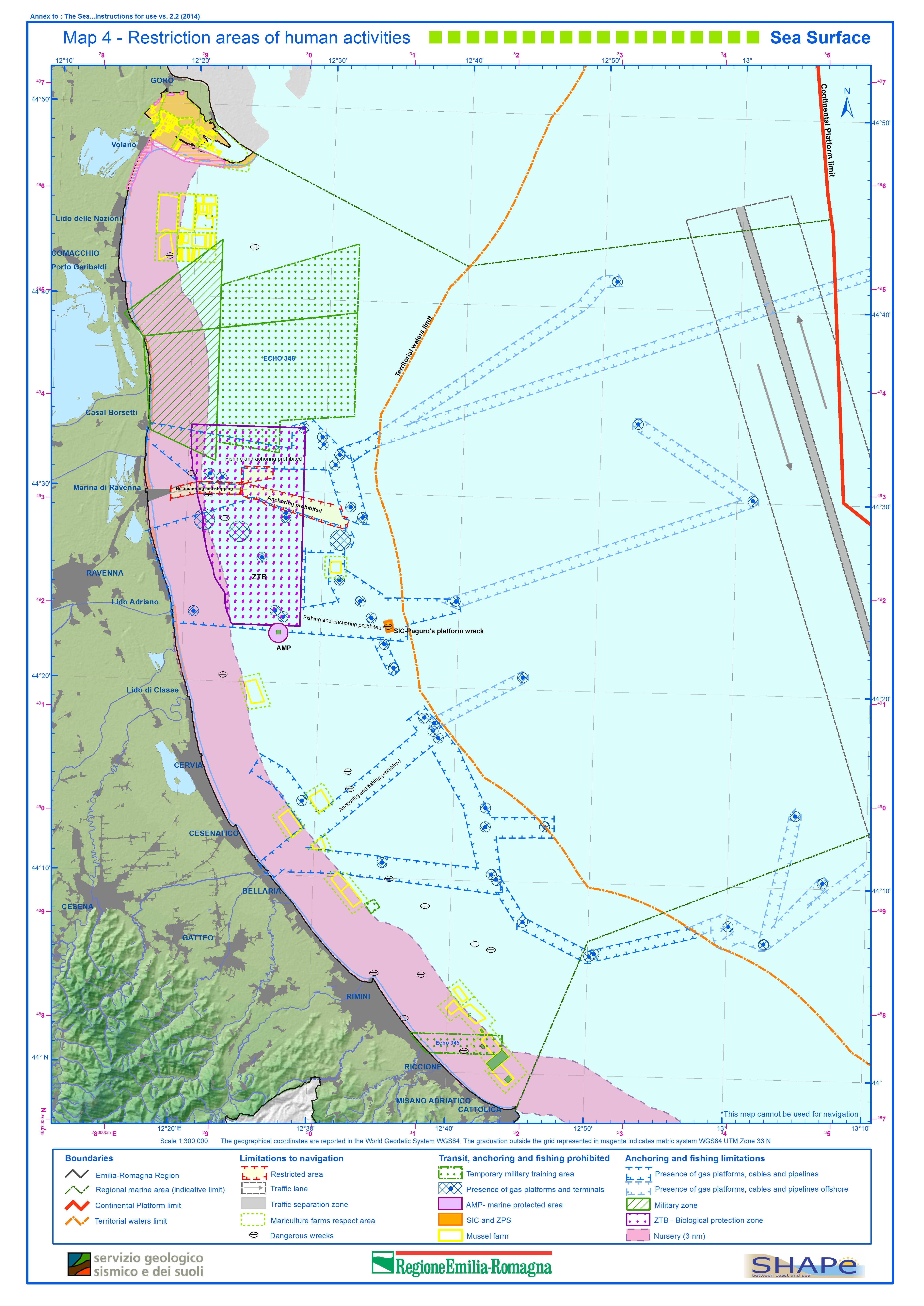
Map 4 Restriction areas of human activities – Sea Surface
