Shallow groundwater monitoring network
Monitoring network useful for irrigation management
The monitoring network is able to provide up-to-date information on the depth of the surface water table (maximum 300 cm). It was promoted and financed by the region since 1997 and is currently managed by C.E.R. (Consorzio di Bonifica di Secondo Grado per il Canale Emiliano Romagnolo - Consortium of Second Grade Land Reclamation for the Emilia-Romagna Canal).
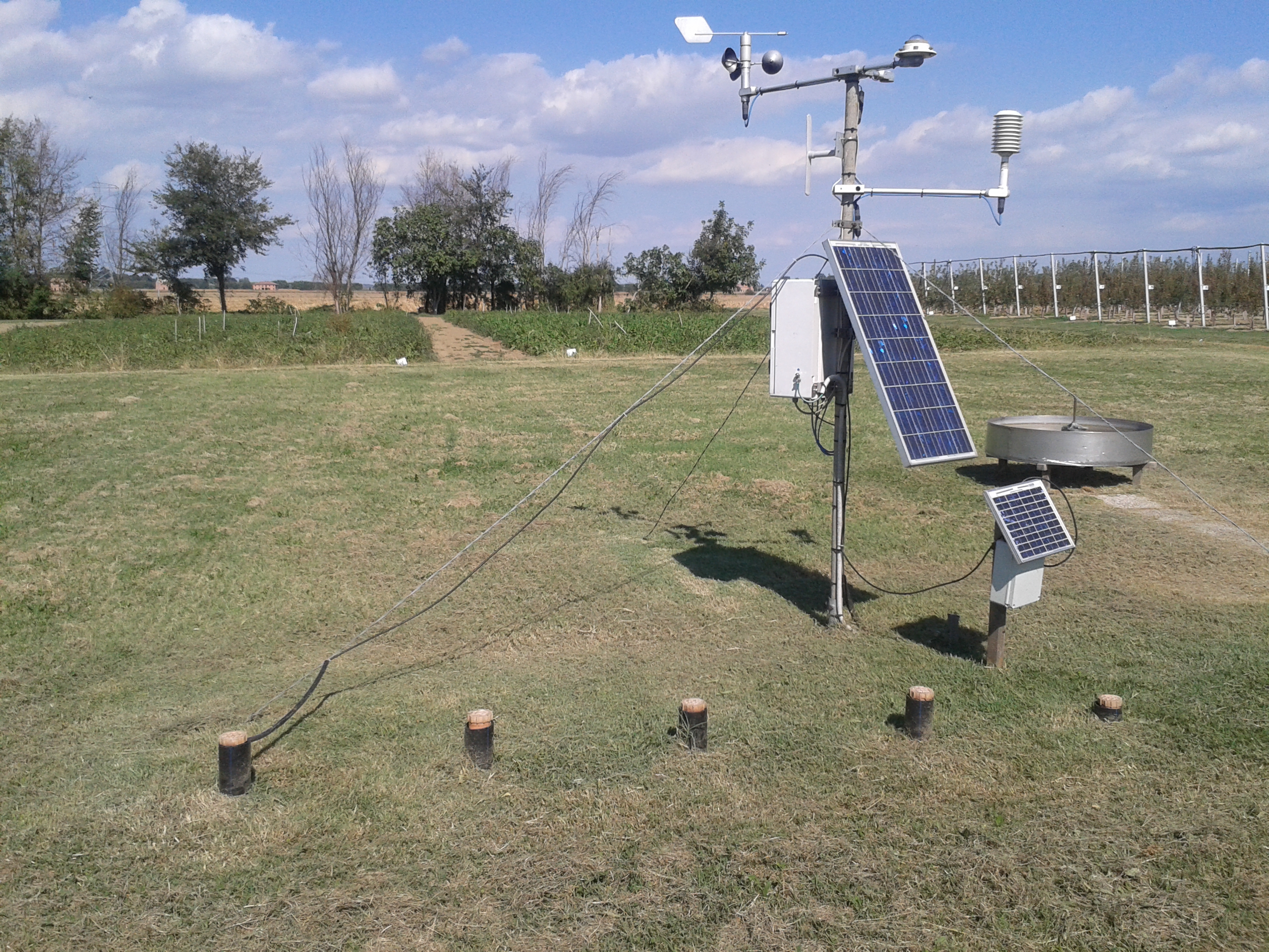
The network currently consists of 121 monitoring stations distributed throughout the plain (northern part of the region). Each station is equipped with 2-5 piezometers, up to a maximum depth of 300 cm, in which the presence of the water table is measured at varying intervals depending on the season. Water depth data are collected approximately every 10 days in the growing season. They can be used to calibrate irrigation recommendations, using the IRRINET web service. IRRINET is the irrigation service created by CER , available to all farms in Emilia Romagna. It is a free service that provides irrigation advice on when to intervene and the water volumes to use in order to obtain a quality product while saving water resources. It is based on the water balance method, which is calculated daily using meteorological data, data from the soil map at 1:50,000 scale and groundwater data from the network.
Figure 1. Monitoring station 19BO (photo by Raimondi)
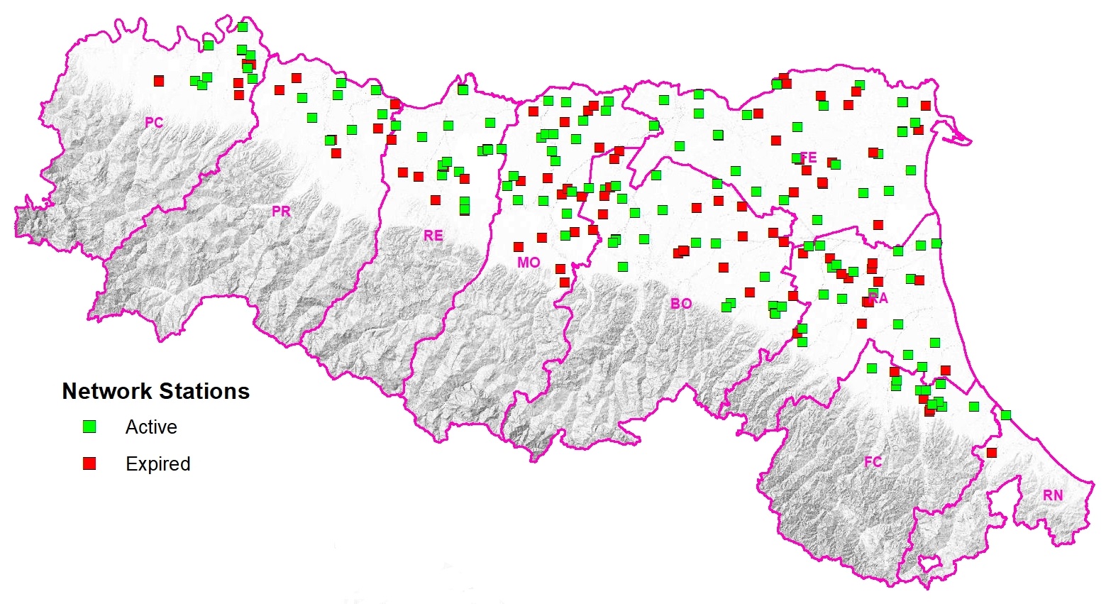
Figure 2. Location of the network stations in the provinces of Emilia-Romagna. DOWNLOAD
Consultation
The monitoring service can be consulted via an interactive map (FALDANET) showing the shallow groundwater map by class and the location of each monitoring station, identified by a code. By selecting one of the points on the map, you can access the depth data recorded since the station was activated.
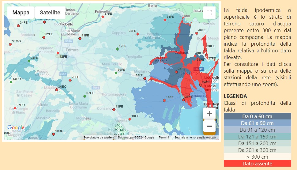
Figure3. Map of the shallow groundwater table. The map changes every few days. No data in red
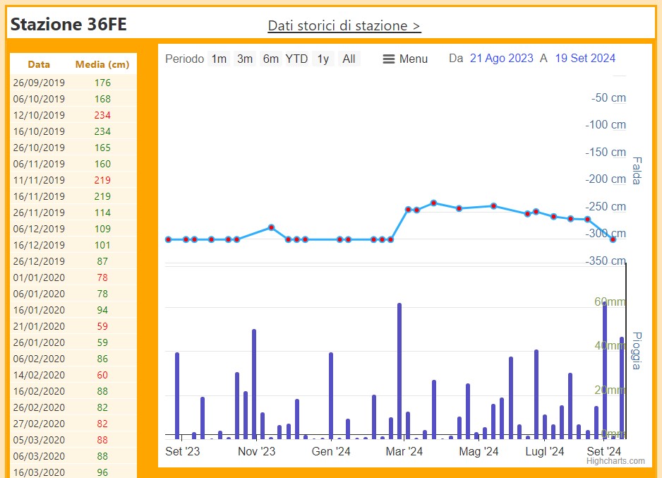
Figure 4. Example of data available for a station: average water table depth and precipitation
Precautions for use
The location of the stations is the result of a study of the territorial characteristics (nature of the soils, recurrence of stagnation phenomena, presence of irrigated crops, activities of the Land Reclamation Consortia, etc.). The small number of stations and the uncertainty regarding the geographical distribution of the shallow groundwater limit the representativeness of the information to areas adjacent to the survey points. Any extrapolations require an in-depth assessment of environmental, cultivation and district water resource management factors.
