Cartography
9 trails maps that cover the entire route and the whole territory of the involved Parks. The single maps and the box set, how and where to buy them.

The 9 trails maps are printed on a special paper that is water-proof, anti-tear and totally recyclable. They cover the entire route and the whole territory of the involved Parks and they are characterized by the 1:50'000 cartographic scale, purposely created by the Regional Cartographic Archive.
They are available for purchase by single map (6€ each) or by box set (collection of all the 8 maps, 28€), at the Regional Cartographic Archive, the Parks Visitor Centers, the stage services and the main book shops. Card n. 9 is not enclosed in the box.
The regional cartographic archive applies a 15% discount on the cover price to the employees of the Region, to the CAI associates and to the members of environmental associations.
- Buy the box set
- Buy the single maps:
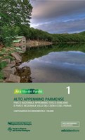
Alta Via dei Parchi map n.1 - High Appennino Parmense - Appennino Tosco-Emiliano National Park and Valli del Cedra e del Parma Regional Park;
Alta Via dei Parchi map n.2 - High Appennino reggiano - Appennino Tosco-Emiliano National Park;
Alta Via dei Parchi map n.3 - High Appennino modenese - Alto Appennino ModeneseRegional Park and Corno alle Scale Regional park;
Alta Via dei Parchi map n.4 - High Appennino bolognese - Corno alle Scale Regional Park and Laghi di Suviana e Brasimone Regional Park;
Alta Via dei Parchi map n.5 - Appennino Imolese - Vena del Gesso Romagnola Regional Park;
Alta Via dei Parchi map n.6 - Appennino faentino - Vena del Gesso Romagnola Regional Park - West;
Alta Via dei Parchi map n. 7 - Alto Appennino forlivese - Foreste Casentinesi, Monte Falterona e Campigna National Park - North;
Alta Via dei Parchi map n. 8 - Alto Appennino forlivese e cesenate - Foreste Casentinesi, Monte Falterona e Campigna National Park – South.
Alta Via dei Parchi carta n. 9 - Appennino Tosco-Romagnolo e Marchigiano - Parco nazionale Foreste Casentinesi, Monte Falterona e Campigna e parco Interregionale Sasso Simone e Simoncello (NEW 2025)
