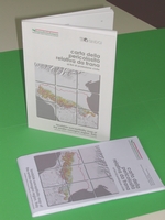
Landslide susceptibility map of the Emilia-Romagna Region, Italy - landslide relative hazard map for civil protection purposes
Volume 109 pages + Landslide susceptibility map of the Emilia-Romagna Region, Italy, in scale 1:250.000, italian and english languages, 2002

Description:
Volume 109 pages + Landslide susceptibility map of the Emilia-Romagna Region, Italy, in scale 1:250.000, italian and english languages
Abstract:
The "Landslide susceptibility map of the Emilia-Romagna Region, Italy", produced at scale of 1:25.000 and publicated in scale 1:250.000, classifies the regional territory in areas according to diverse instability predisposition, concerning the mobilization of masses of rock or soil. It may be useful as a bibliographical resource and can supply information for regional planning.
Publisher:
Emilia-Romagna Region, Italian National Research Council
Authors:
Emilia-Romagna Region: Geological Sismic and Soil area, Servizio Provinciale Difesa del Suolo di Reggio Emilia, Servizio Protezione Civile, Servizio Idro-Meteo; Italian National Research Council: GNDCI
Year of publication:
2002
Price:
Euro 10,00
Buy it on web:
The Bookshop of Emilia-Romagna
Informations:
phone: +39 051-5274792
send an e-mail
