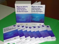
Groundwater reserves in the Emilia-Romagna region
9 maps in scale 1:250.000 of the three main acquifers A B C identified in the alluvial plane and technical report

The large quantity of data collected by the two structures about the Plain underground gave the chance to update the knowledge framework on the sedimentary evolution of the Po alluvial basin. Its fresh water reservoirs are a key element for the regional economy.
The recent theoretical progresses in the stratigraphic field, which allow new possibilities of correlation and three-dimensional reconstruction of sedimentary bodies even within the complex world of alluvial sediments, have been an incentive for the project.
The acquired knowledge on the relationship between aquifers and the corresponding recharge areas showed the inadequacy of the monoaquifer (monofalda) model, mostly used on the plain, determining a new scenario for planning choices in hydrogeologic protection.
Many specialists of different earth science branches have been directly or indirectly contributed to this work. The research integration allowed the genetic interpretation of the regional aquifers architecture which is believed the base of all the detailed deepening.
The amount of theoretical and practical problems evidenced in this work would need a study much more detailed than the present one. Nonetheless, it is important to present by now the regional framework of the new information, carrying innovation into practical applications. Actually, the final chapters of the work are oriented to practical applications.
The work (italian language) objectives can be summarized in four points:
A) Represent in three-dimensional models the internal structure and the physical limits of the Emilia-Romagna region aquifers;
B) Locate the biggest and largely protected aquifers which constitute a strategic reserve;
C) Map the recharge areas of the Plain aquifers;
D) Allow the computation of hydrological balances and underground water reserves to the regional and provincial scales.
Abstract
Three Aquifer Groups have been recognized below the Plain and on the Po Apennines Margin.
They are separated into permeability barriers of regional extension and are informally called Aquifer Group A, B and C, from the surface top downward.
- The Aquifer Group A is presently exploited in an extensive way;
- The Aquifer Group B is only locally exploited;
- The Aquifer Group C, mostly isolated for a large part of its extension, is rarely exploited.
The internal architecture and the petrophysical characteristics of the mentioned Hydrostratigraphic Units are the result of the tectonic and depositional history of the sedimentary basin.
Edited by
Regione Emilia-Romagna, Geological, soil and seismic risk area, and ENI - AGIP (Italian company for hydrocarbons)
Authors:
Regione Emilia-Romagna, Geological, soil and seismic risk area, ENI - AGIP
Year of publication:1998
