Regional monitoring of agricultural soils
Monitoring of the chemical-physical and biological properties of agricultural soils
An agricultural soil quality monitoring project (chemical-physical and biological characteristics) was conducted in the 2018-2023 period.
The project was funded by the 2014-2020 Rural Development Plan for a total of 517,523 euro VAT included. It was followed in its development by the Geology, Soils and Seismic Area in agreement with the Programming, Territory Development and Production Sustainability Sector of the Agriculture Directorate. The field surveys were carried out by the company I.ter, while the chemical-physical analyses were performed by the C.S.A. laboratory.
The project consisted of two macro-activities:
- Implementation of a soil quality monitoring network consisting of 123 sites; sampling was carried out firstly in 2019 and repeated in 2022. Physical, chemical and biological analyses were carried out on the collected samples.
- Topsoil sampling in 2270 sites (defined as SACT) and soil chemical-physical analyses. The sites were sampled both in the plain and in the hills; sampling and analyses were spread over the entire five-year period.
Monitoring network
The monitoring network consists of 123 sites, located in the alluvial plain (86) and hills (37) of Emilia-Romagna region. The sites were chosen according to the following criteria:
- accession of farms to Measures M10 (integrated pest management) and M11 (organic farming) of the 2014-2020 RDP;
- representativeness of the main agricultural soils of the plain and hills;
- representativeness of the main land uses such as orchards and vineyards, arable crops, grassland and permanent meadows.
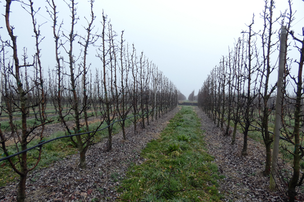
Pear orchards
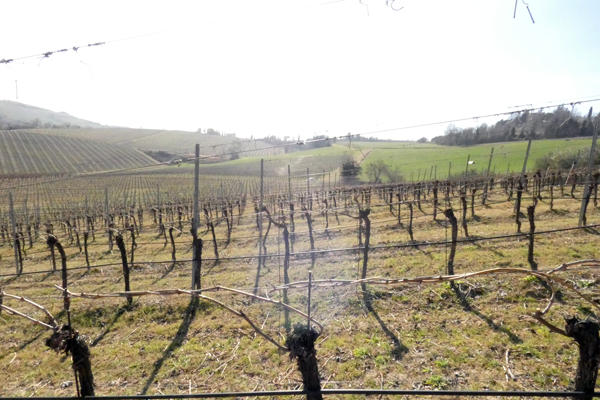
Vineyards
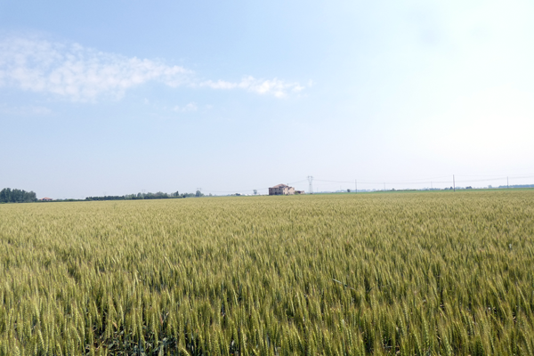
Arable crops
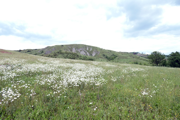
Meadows
On the basis of these principles, 60 farms that adhered to RDP measures M10 or M11 (PSR) were selected and each of these is accompanied by a nearby counterfactual farm (DU), with similar soils, that does not adhere to the RDP measures. On the 120 farms, a survey on the land management was carried out for the years 2017-2022. 3 farms with permanent grasslands do not have the respective counterfactuals.
LAND COVER | INT. DU | INT. PSR | ORG. DU | ORG. PSR | CONS. DU | CONS. PSR | MEAD. PSR |
ORCHARDS | 8 | 8 |
|
|
|
|
|
VINEYARDS | 12 | 12 | 6 | 6 |
|
|
|
CROPS | 12 | 12 | 16 | 16 | 6 | 6 |
|
MEADOWS |
|
|
|
|
|
| 3 |
Table 1. Distribution of monitoring sites by land use and management. INT: integrated pest management; ORG: organic farming; CONS: conservation agriculture; MEAD: meadows
Each site is characterised by a soil observation (borehole) and the topsoil was sampled and analyzed with routine chemical-physical analyses. Sampling was carried out according to the scheme in Fig. 1 for each site; biological soil quality (QBS-ar index from Parisi 2001, Parisi 2005) and metal and metalloid content were also monitored at 49 sites. Constant quality control was performed on the analytical data through the use of certified samples.
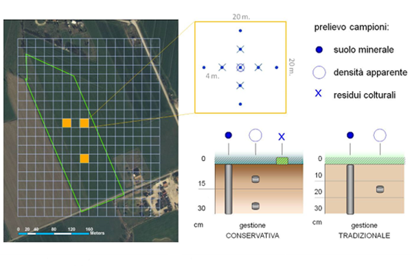
Figure 1. Sampling schema
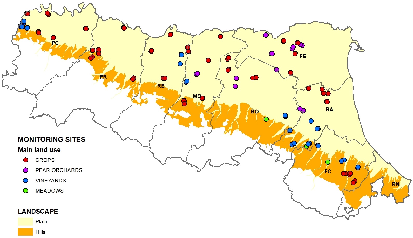
Figure 2. Distribution of monitoring sites according to land use
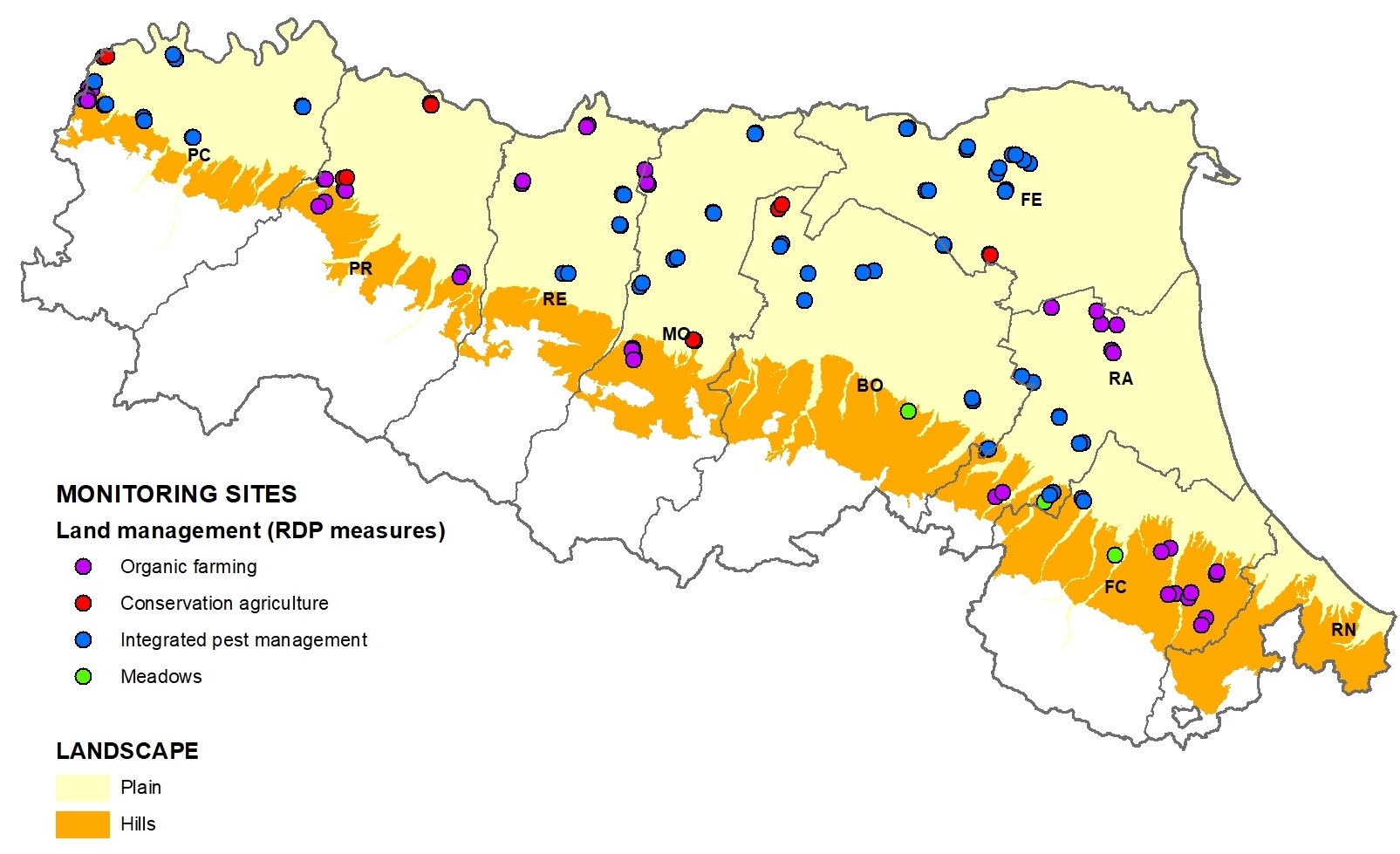
Figure 3. Distribution of monitoring sites according to RDP measures
MONITORING NETWORK ACTIVITIES 2019-2022
SACT sites sampling
The objectives of this macro-activity are to update and enhance the regional reference knowledge framework, consisting of the Soil Information System, soil maps, thematic maps and cartographic websites. These analyses also provide up-to-date data for the compilation of fertilisation plans (on the Soil Catalogue website).
Composite sampling of the surface layer (0-30 cm) of 2270 sites was carried out: 10 sub-samples were taken from the sampling area (minimum 5000 square metres) and mixed into a single sample. In the centre of the plot, a borehole was drilled to a depth of 150 cm for soil characterisation. 49% of the boreholes drilled (1121) were sampled in full.
Routine chemical-physical analyses were carried out on the composite samples; quality controls were performed on a number of certified samples provided by the Regional Enviromental Agency (ARPAE) laboratory equal to 2% of the total.
The data were made available on the websites at the end of each year of activity. They can also be viewed as a WMS service (URL: https://servizigis.regione.emilia-romagna.it/wms/suoli)
SACT SITE ACTIVITIES 2018 - 2023
Reports (italian language)
- Risultati dell'attività di monitoraggio sulla qualità dei suoli agricoli 2019-2022 (2024)
- Analisi dei terreni della regione Emilia-Romagna (2023)
Field books (italian language)
- Guida di campagna per la descrizione delle osservazioni pedologiche, 2020 (2.58 MB) (PDF - 5,4 MB)
- Guida per il campionamento terreni, 2017 (593.47 KB) (PDF - 579,6 KB)
- Guida per il campionamento della rete di monitoraggio dei suoli, 2020 (PDF - 1,9 MB) (1.96 MB)
- Scheda per la descrizione dei monitoraggi, 2020 (60.86 KB) (PDF - 161,4 KB)
- Manuale per l’immissione dati delle osservazioni pedologiche, 2017 (920.82 KB) (PDF - 899,2 KB)
- Manuale per l’immissione dati microbiologia del suolo, 2016 (1.06 MB) (PDF - 1,2 MB)
Area Geologia, Suoli e Sismica
Settore programmazione, sviluppo del territorio e sostenibilità delle produzioni
