
Soil erosion
Evaluation of the water erosion of the soil
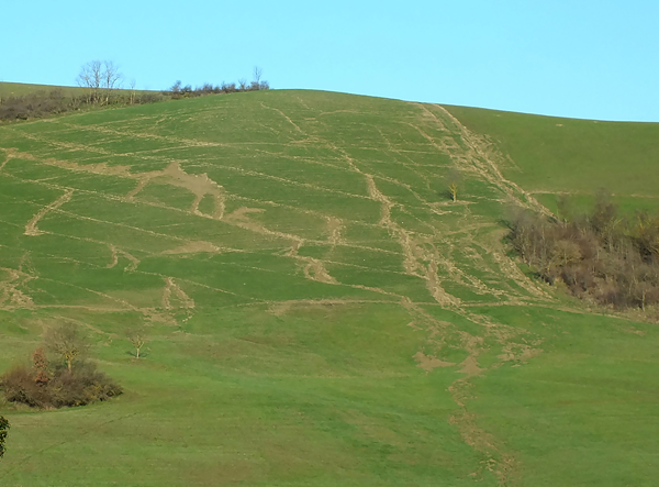
Soil water erosion is the loss of the most superficial layer of soil due to the action of rainwater; the removal of soil not only causes loss of functionality and damage in situ but also has repercussions in more distant locations due to the transport of soil material in the hydrographic reticulum. The Emilia-Romagna Region is occupied for 51% of its territory by the Apennine chain reliefs. The morphology of the slopes, the type of substrate and the agricultural use of the soil make these territories particularly sensitive to various forms of hydrogeological instability, among which surface water erosion is particularly insidious.
For the assessment of water erosion, the Universal Soil Loss Equation of Wischmeier and Smith (USLE) in the version of Renard et al.1997 (RUSLE) was applied. The use of modelling is the only tool that can be used in the absence of real monitoring that would allow direct measurement of the phenomenon, although it provides an approximation of the real situation whose accuracy depends not only on the type of model used but also on the quality of the input data and the weight given to the various parameters used.
The RUSLE model provides an estimate of soil loss due to water erosion expressed in Mg*ha-1*year-1 as a long-term annual average. The estimated value is always related to specific combinations of slope topography, land use and management practices in a given climatic and environmental context.
The present edition (2025) is the fourth version of the erosion map and covers only the hilly and mountainous areas (defined as the RUSLE area). The new map was produced as part of the assessment procedures for the 2014–2020 Rural Development Programme (RDP) by the DAFNE department of the University of Tuscia on behalf of Agriconsulting Supporto Istituzionale S.r.l.
At regional level, the average annual soil loss due to water erosion was estimated at 7.45 Mg*ha⁻¹*year⁻¹, which equates to a total annual soil loss of 16.8 Mt/year. Consequently, 24.4% of the entire regional territory has values > 2 Mg*ha⁻¹*year⁻¹, considered to be the rate of new soil formation from the substrate according to Montgomery (2007), whilst 12.8% has values > 11.2 Mg*ha⁻¹*year⁻¹, indicated by the USDA as the maximum tolerable soil loss.
Available maps
The map of the soil water erosion, in GEOTIFF format with a resolution of 10 m, can be downloaded from MinERva portal.
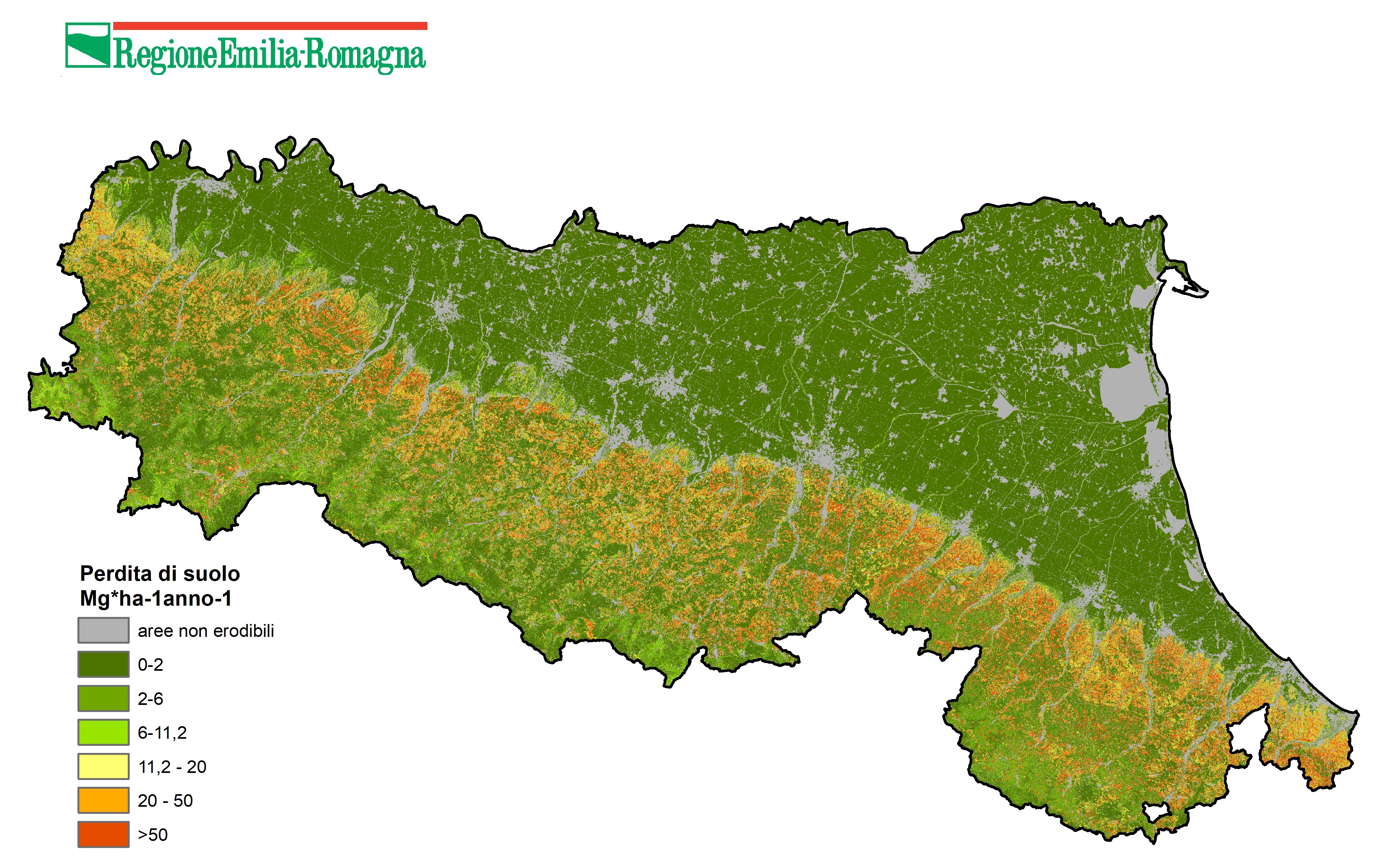
Soil water erosion (Mg*ha-1*year-1) - RUSLE model (2025). DOWNLOAD
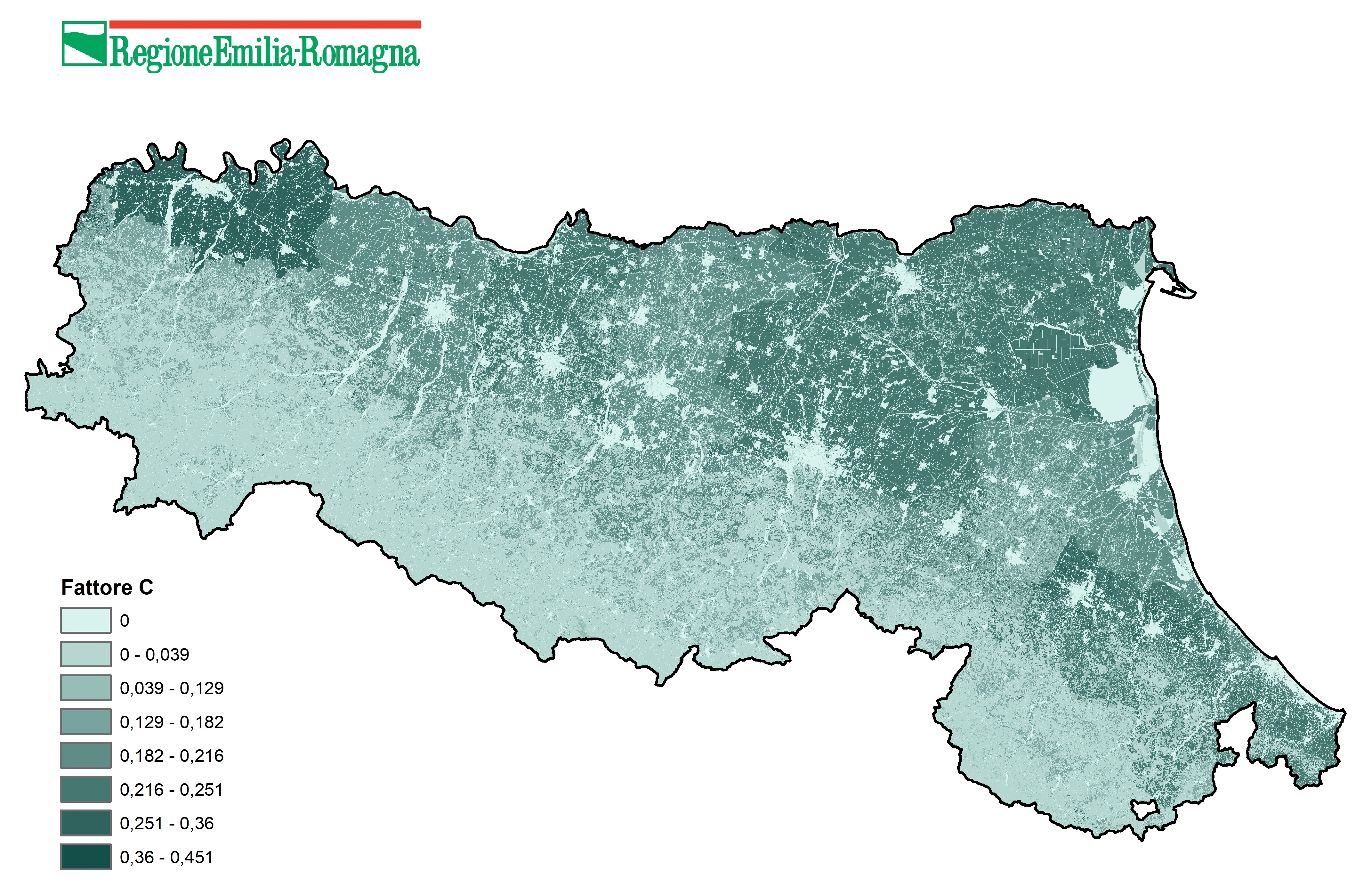
Cover Management Factor (C-Factor)
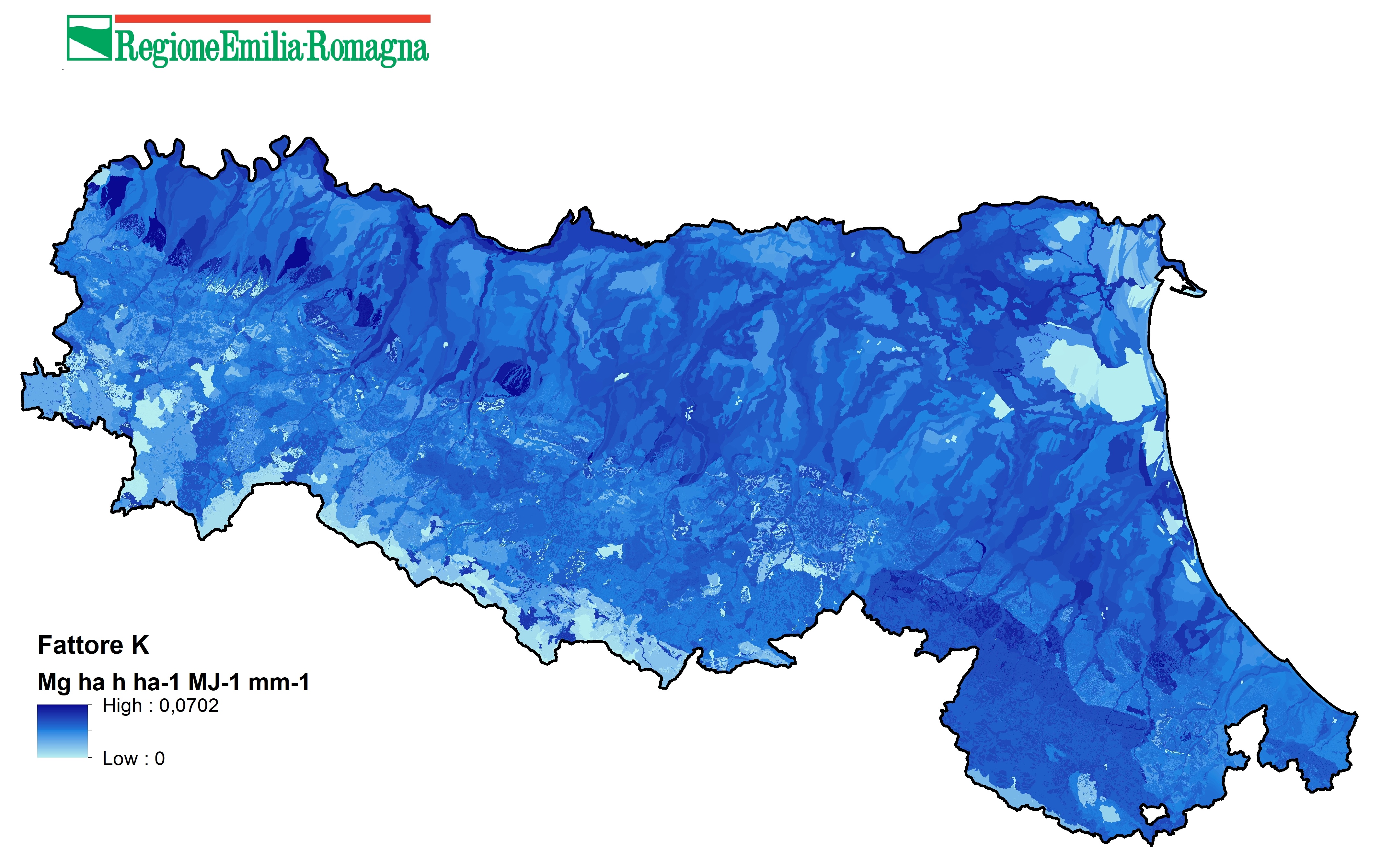
Soil Erodibility Factor (K-Factor)
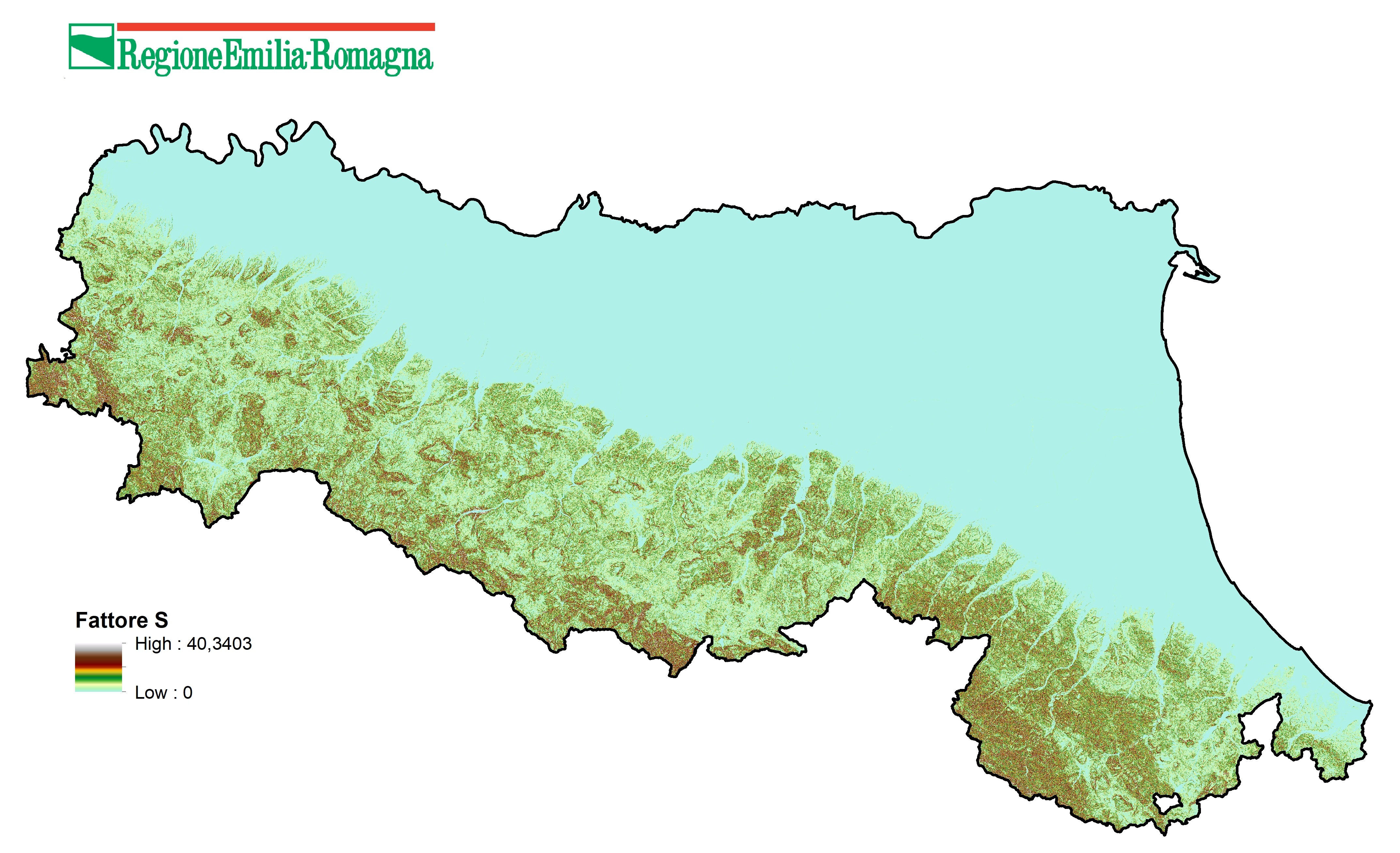
Slope angle factor (S-Factor)
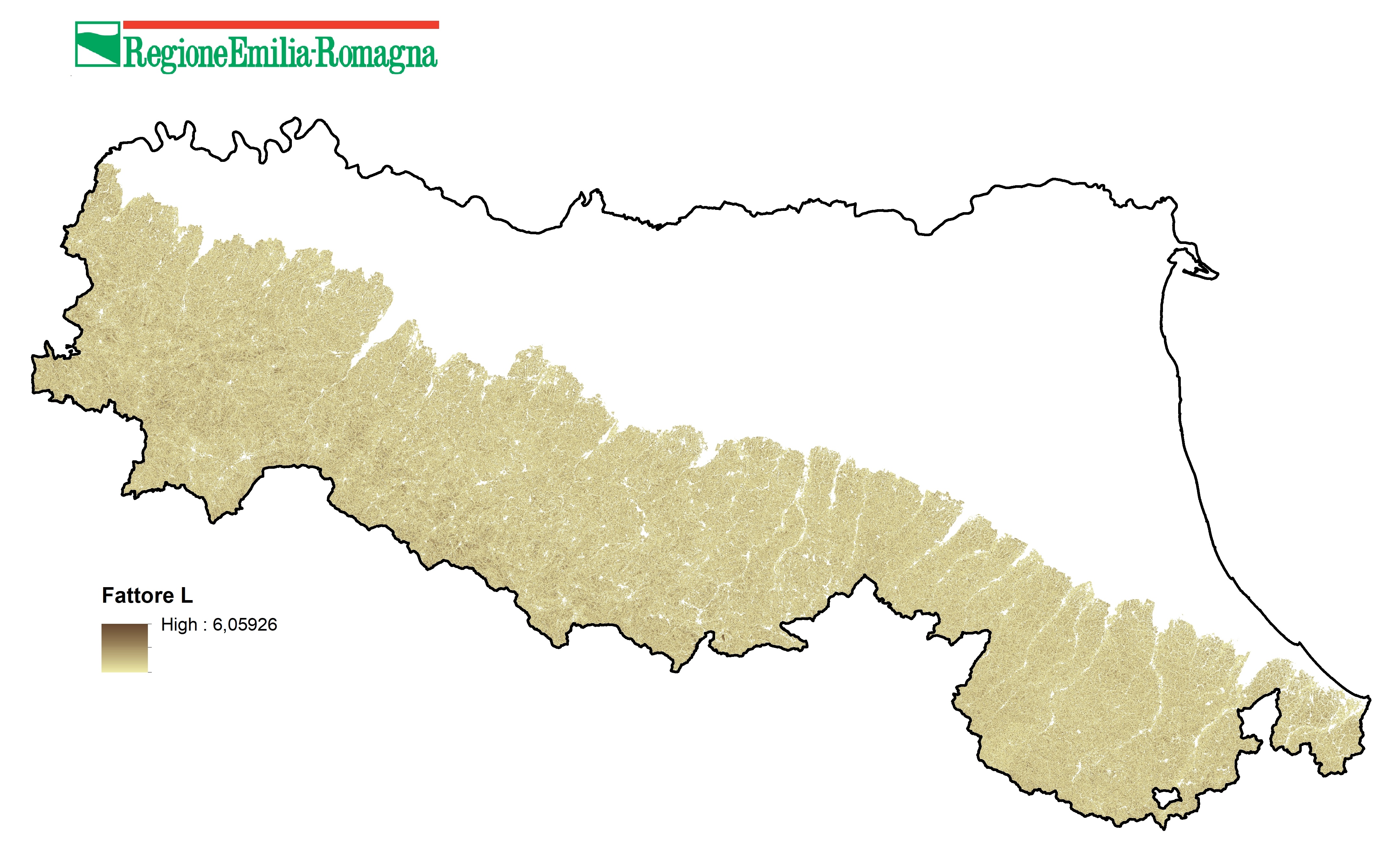
Slope Length factor (L-Factor) for the RUSLE area
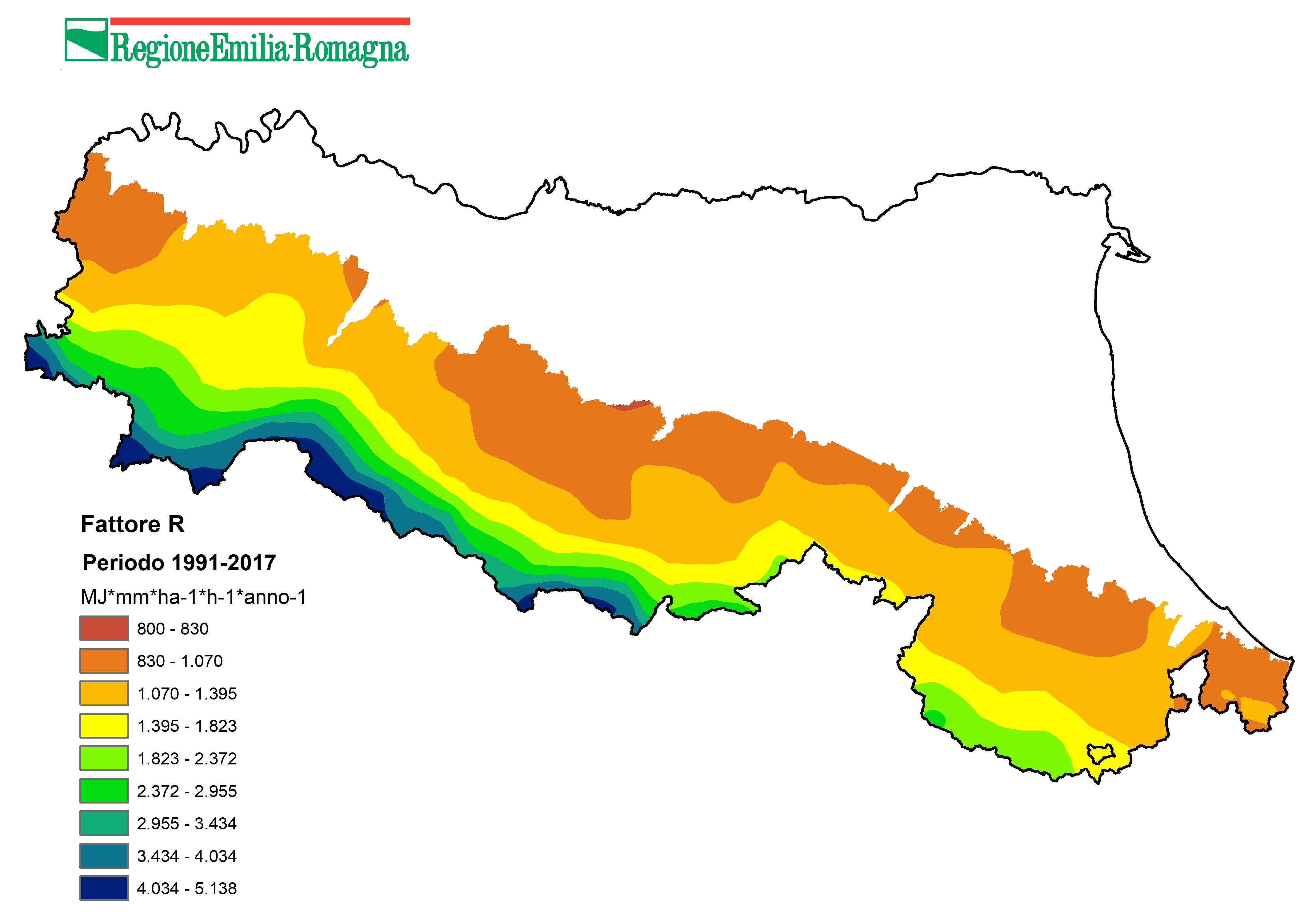
Rainfall-runoff erosivity factor (R-Factor) for the RUSLE area
Documents
- Note illustrative della carta dell'erosione (2025) (in italian language)
- Soil erosion the greatest challenge for sustainable soil management
- Global Symposium on Soil Erosion. Outcome Document. (15-17 May 2019 - Rome, Italy)
Contact us