Ciclovia della Memoria
Monte Sole Historic Regional Park
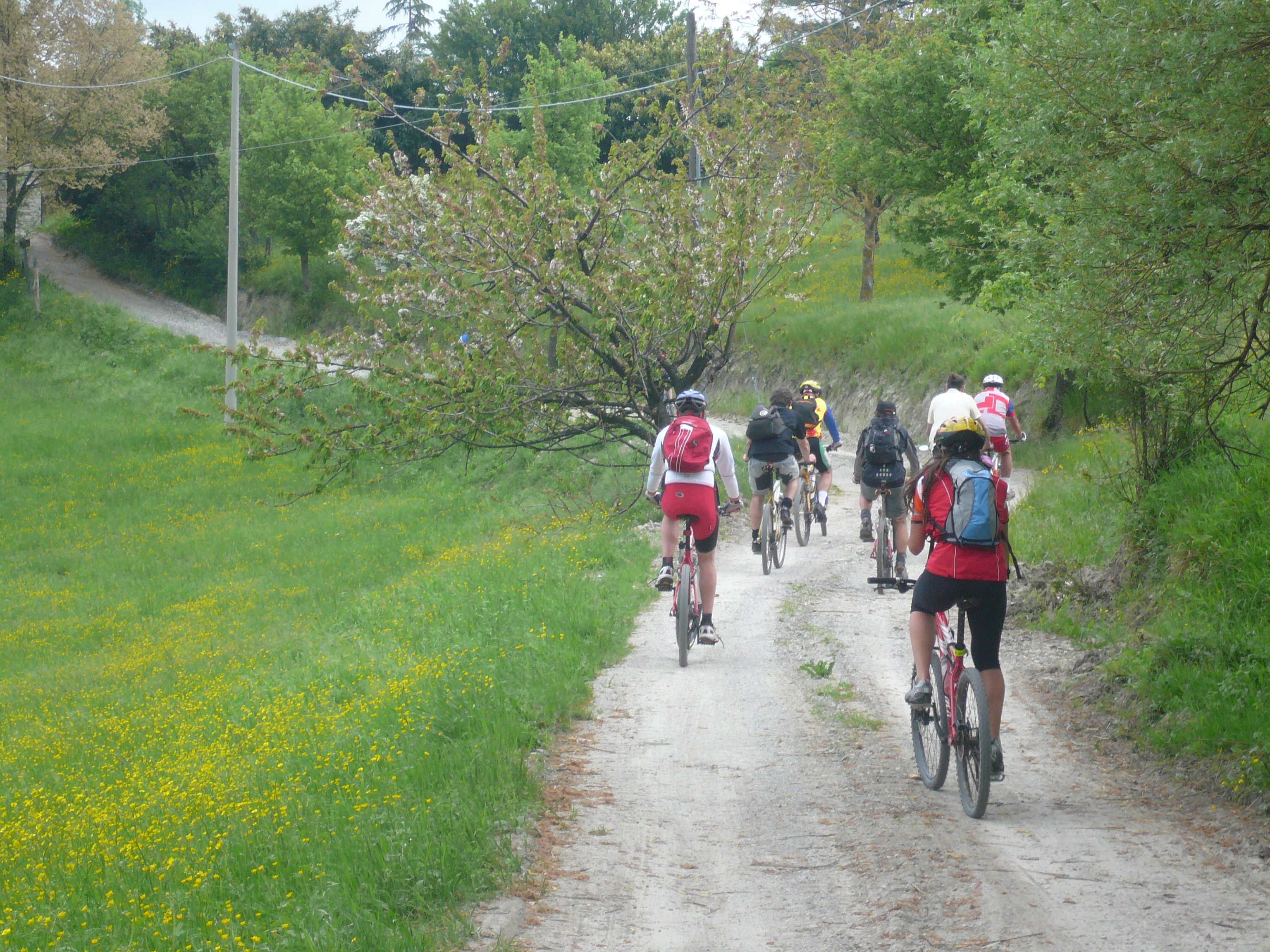
This is a very rewarding itinerary despite (actually, for some people because of) the significant physical effort required, due to the gradient, the relevant length of the route and the recurring presence of muddy stretches.
The place for sure has features of high interest in terms of landscape (long stretches of ridge between Reno and Setta valleys, with panoramic views), botany (mixed deciduous forests typical of the medium Apennine mountains next to peculiarities such as the cliff formations of holm oak or Scots pine), and fauna (chance of spotting herds of ungulates, not to mention the presence of the wolf, by now stable). Yet, it should be emphasized how this is essentially a historical and memorial park, linked to the memory of the most painful massacre of civilians carried out by the Nazi occupiers in Italy.
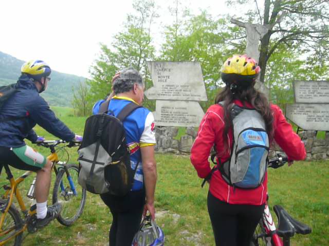
You depart from the railway station of Lama di Reno and reach the Romanesque parish church of Panico, which is woth a visit, and then you ride up to San Silvestro, on the ridge between Reno and Setta valleys, which in practice represents the backbone of the route. Leaving behind the often-muddy stretches of clay, you’ll reach the sandstone formations of Monte Sole. You’ll bypass the top of this mountain via a long detour passing through the nearby Oratory of Cerpiano and the cemetery and church of Casaglia. These buildings, like the others along the route, are the silent witnesses of the massacre that resulted in the destruction of the community of Monte Sole in the autumn of 1944 (770 victims, 955 in total during the occupation). They were consolidated but not rebuilt and they were entrusted with the task of handing down “what happened” and the message that “this must never happen again.”
The return path starts from the park visitors centre “Poggiolo” along the small road that goes down to Sperticano and Pian di Venola, where you can take the train.
THE OTHER CICLOVIE -->
ELEVATION PROFILE
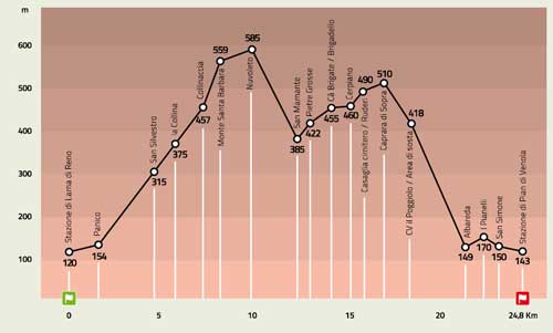
Download the elevation profile (JPEG - 202,0 KB)
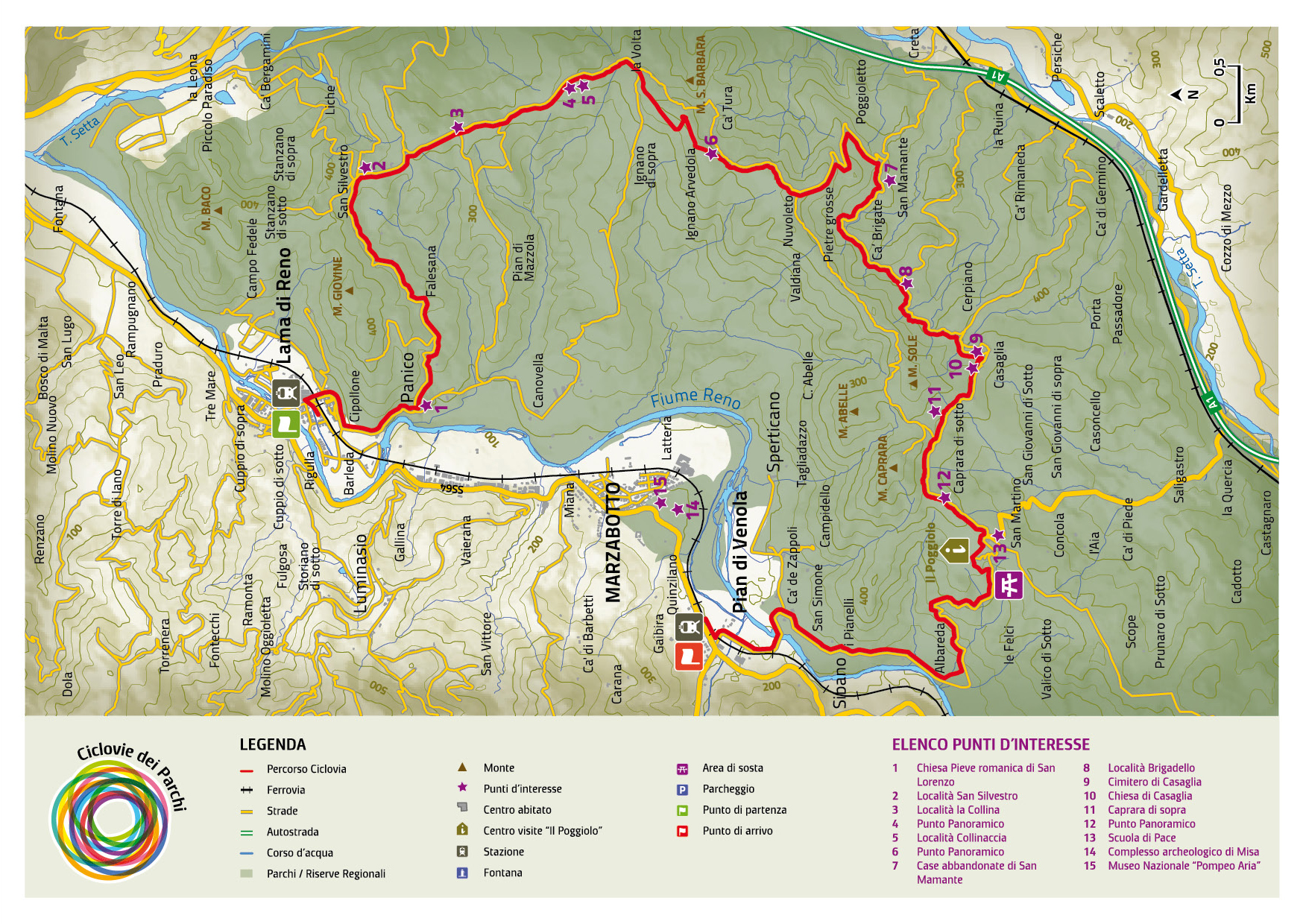
CARTOGRAPHY

Download the map of the route (JPEG - 1,9 MB)