Soil maps in Emilia-Romagna region
Available soil maps at different scales and their state of implementation and updating
Soil maps are thematic maps representing the geographical distribution of soils and describing their main chemical and physical characteristics and qualities. They provide a simplified image of natural reality, depending on the scale of the survey and the intended purpose. Being a model of reality, the way in which it is represented (drawing of polygons, description of contents, description of soils) depends very much on the experience and sensitivity of the authors of the map.
Soil maps provide useful information for assessing the suitability of a territory to be used for a variety of activities and sectors (agriculture, forestry, urban planning, industry, roads, leisure, etc.), constituting an important aid in land management and planning.
The Emilia-Romagna soil survey began in 1976 and was carried out at different levels of detail and by successive approximations.
- Scale 1:1,000,000 - Provides an overview of the main geo-morphological environments and the pedogenetic processes that characterise the soils in them. It was published in 1994 and is currently being revised.
- Scale 1:500,000 - Provides a more detailed framework than the 1:1,000,000 level soil-environment relationship. It was published in 1994 and is under revision.
- Scale 1:250,000 - In addition to the framing of the main genetic and functional characteristics of the soils of the regional territory, it provides an initial view of the problems connected with their use. It was published in 1994 and is currently being revised.
- Scale 1:50,000 - Defined as semi-detail scale, it is the most suitable map as a support for feasibility projects and for territorial planning at sub-regional level. At this scale the soils of the plain, the lower Apennines (hills) and part of the middle Apennines are described, as well as some sample areas in the middle and upper Apennines (not published). A special feature of this map is the description of the soils per single polygon and not only per map unit; furthermore, a local representative site is linked to each soil for each polygon, accompanied by chemical-physical analyses. This allows the map to be used also at farm scale and for site-specific studies. Last update in 2021 covers 78% of the regional territory.


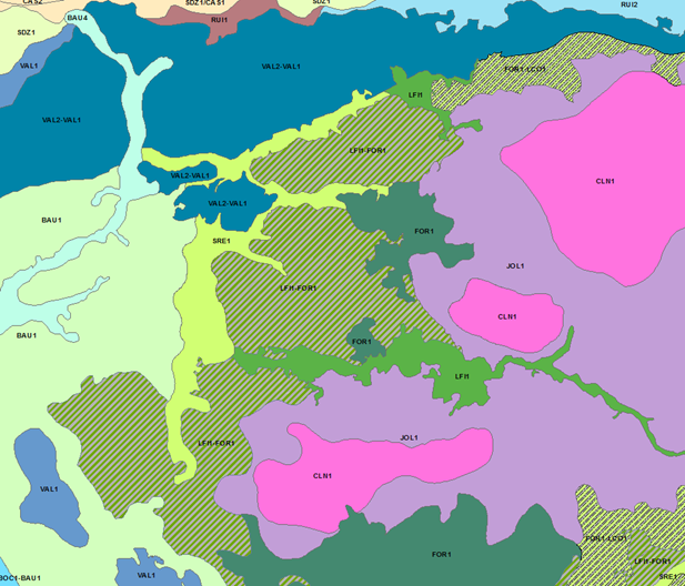
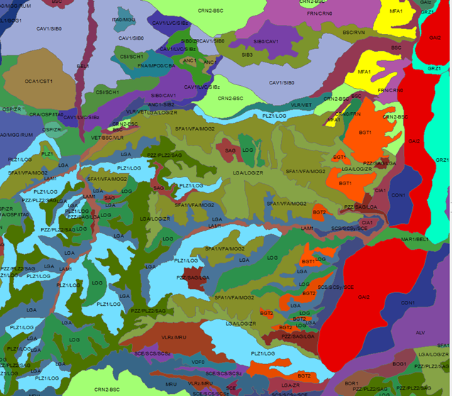
Fig. 1 Example of mapping units of the soil map at 1:50.000 scale.
Soil maps at1:10,000 scale provide a precise description of the distribution of soils in some experimental farms.
The information, at the different levels of detail, is consistent and complementary with each other, so that in the processing of the data, the ‘passage of scale’, from the particular to the general and vice versa, is possible.
The updating of the soil maps is still in progress, as the approach by successive approximations involves a continuous revision of the already published maps, depending on the state of knowledge acquired.
Soil maps can be consulted on various interactive mapping websites where the description of the main soil types, their agronomic behaviour and some considerations on their agricultural management can also be found.

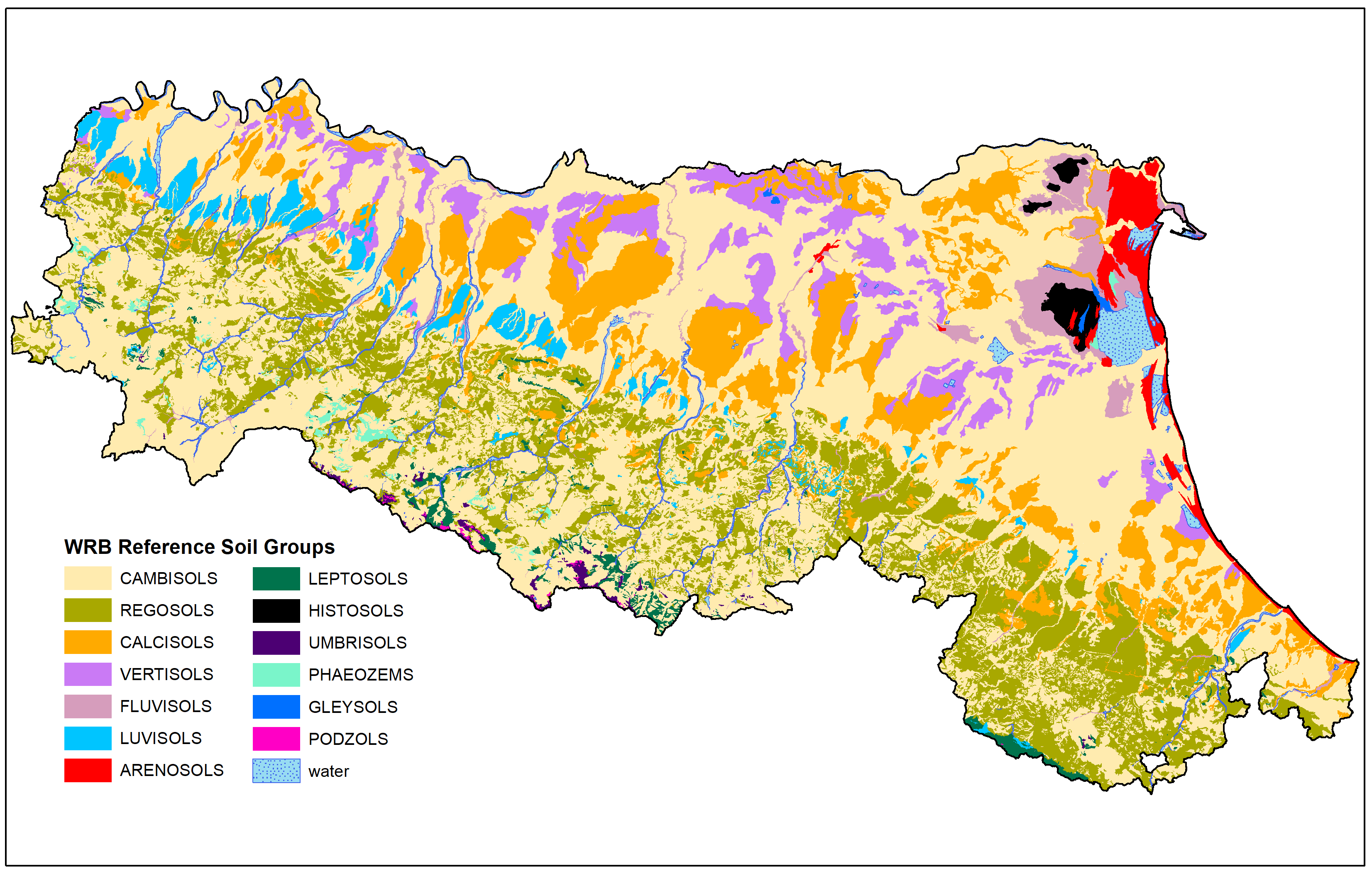
Fig.2 World Reference Base classification. Main Soil Groups in Emilia-Romagna region
In addition to soil maps, various thematic maps, derived from the previous ones, have been produced to meet specific needs. They can be related to individual soil properties (e.g. soil organic carbon maps) or based on the selection and integration of several pieces of information and, if necessary, the use of parametric or mathematical models (e.g. land capability).
In addition to websites, all published maps can also be viewed as WMS services in GIS programmes (URL: https://servizigis.regione.emilia-romagna.it/wms/suoli).
