Soil map at 1:50,000 scale of the Emilia-Romagna region
The most up-to-date information on regional soils
The soil map at 1:50:00 scale is the most suitable map as a support for feasibility projects and for territorial planning at sub-regional level. The 2021 edition covers 78% of the regional territory (entire plain area, 93% of the lower Apennines or hills and 37% of the middle Apennines). Some sample areas in the middle and upper Apennines have also been mapped at this scale (not published at present).
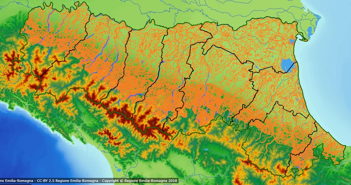
Figure 1. Soil Map at1:50,000 scale edition 2021 (from Cartografia dei Suoli website)
A special feature of this map is the description of the soils per individual polygon (delineation) and not just per map unit. Each delineation of the soil map is identified by a unique numerical identifier and described for its constituent soils. For each soil in each polygon, a local benchmark site is associated, accompanied by chemical-physical analyses and related metadata. This allows the map to be used at farm scale and for site-specific studies. Polygons with similar soil distribution constitute a soil mapping unit.
On all regional websites, the soil map is drawn in transparent mode: by clicking on the individual polygon, the description of the delineation appears via the link ‘Descrizione completa’ and from there it's possible to access the description of the soil typological units (STU) and the mapping unit (SMU). A total of 13,353 soil polygons are delineated, grouped into 820 mapping units.
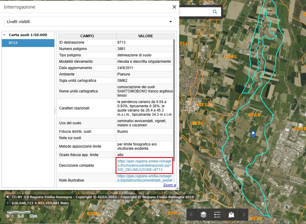
Figure 2. Example of consulting a polygon on the soil map
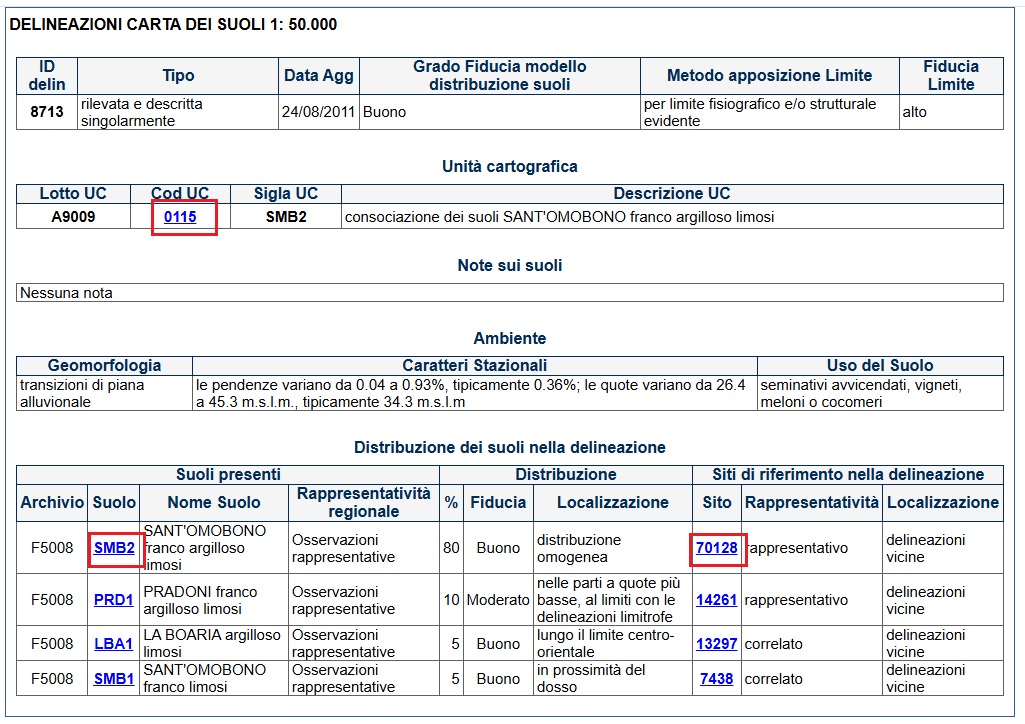
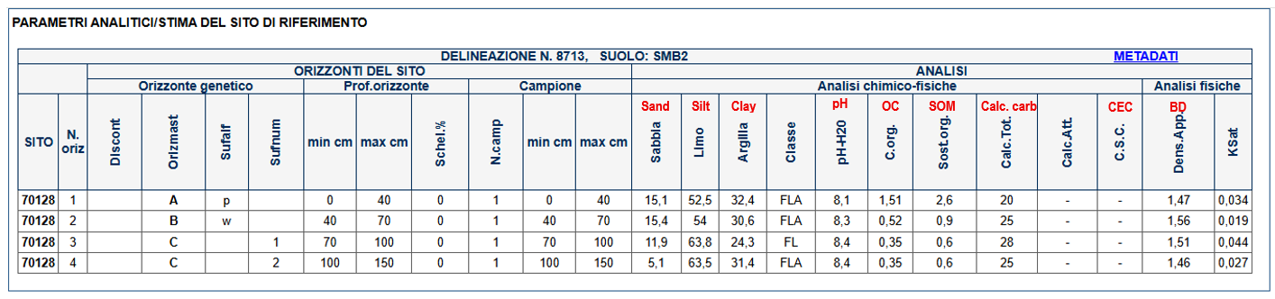
Figure 3. Example of a polygon description on the soil map. From here, it's possible to access the description of the soil mapping unit (Cod UC), soil type (Suolo) and its benchmark local site (Sito).
The soil map available on the websites is now at the fourth/fifth approximation in the alluvial plain (50% of the territory) and at the first/second approximation in the hill and mountain part. Previous editions date back to 1992, 1998, 2005, 2012, 2014, 2015 and 2018. It is the result of surveys carried out from 1980 to 2021 and subsequent correlations, the last of which was completed in 2021. It is possible to download the soil map from the MinERva portal: in the zipped file there are a shapefile in the reference system RDN2008UTM zone 32 (EPSG 7791), an excel file with the description of the delineations, local benchmark sites and classification of the soils and a pdf file with the decoding of the analytical methods.
Associated with the soil map is the Soil Catalogue, which is accessible both via the map and directly. The Catalogue describes (in Italian language) the 466 soil types on the map (210 in the plain, 162 in the lower Apennines, 90 in the middle Apennines and 4 in the upper Apennines). For each soil, there is a general section containing a brief description of the soil, the Soil Taxonomy and WRB classifications, the representative profile, the typical sequence of genetic horizons and specific qualities. For 174 soils of the plain, 31 hillside soils and 8 mountain soils, there are also more detailed fact sheets on management considerations (agronomic qualities, tillage techniques, fertilisation, irrigation) and indications on the choice of crops (agricultural and forestry crops).
Contact us