Ciclovia dei Gessi
Vena del Gesso romagnola Regional Park
This is a long excursion with some gradients, but it may be shortened in many ways if necessary.
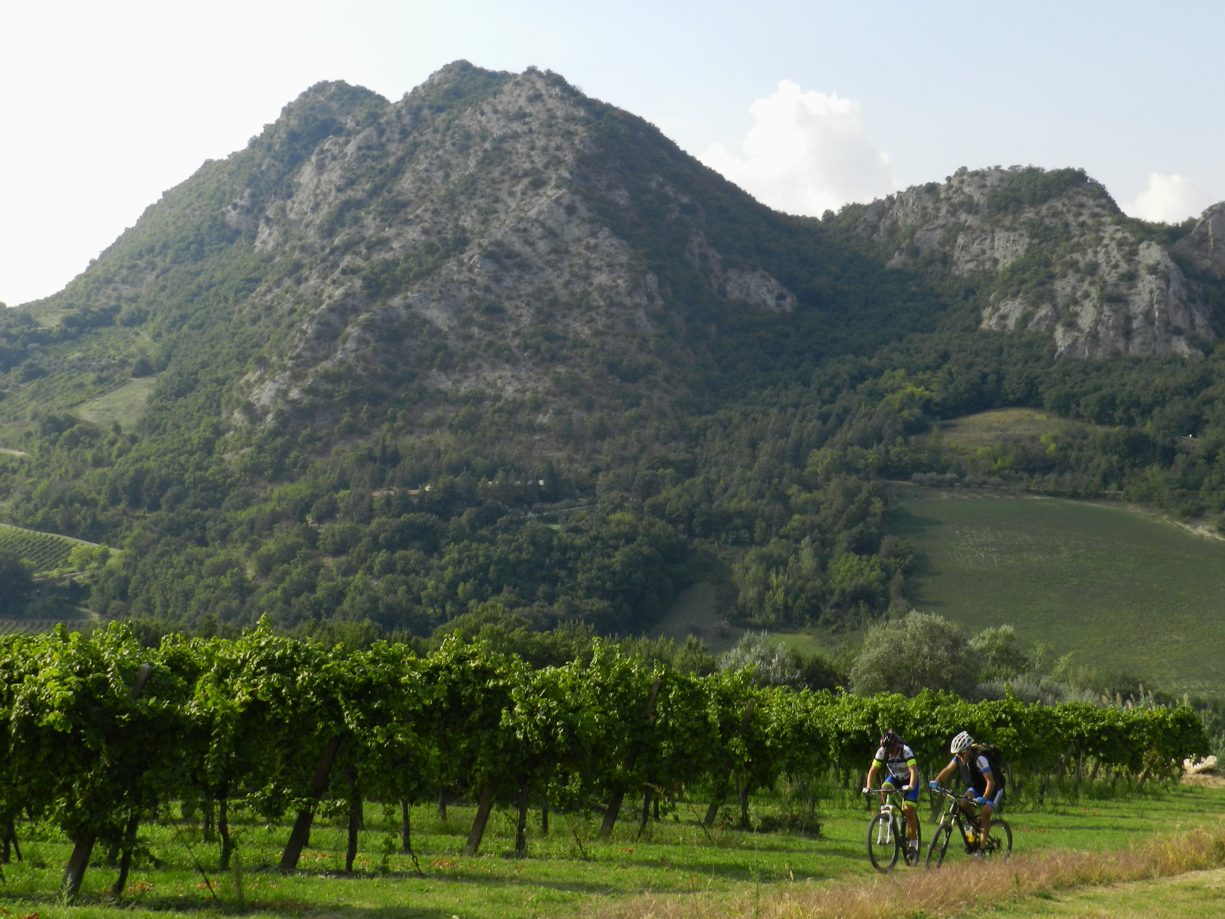
It winds primarily on paved roads with scarce traffic and, if the soil is dry, you can divert through some variations on the trail. The naturalistic attraction of this itinerary lies in the singularity of the rock, the gypsum, protagonist of unusual karst landforms, and substrate for a qualitatively rich vegetation cover, Mediterranean on the south facing slopes and wooded on the north.
From Brisighella railway station you go up on the provincial road heading to Riolo Terme, tuching the Rocca and the Monticino Sanctuary. From here a spectacular and more challenging variant splits off, crossing the “Museo Geologico all’aperto del Monticino” (Open Air Geological Museum of Monticino). This route, which follows the enormous trench of an abandoned quarry, is practicable only when the soil is dry. If you decide not to take this detour, keep to the provincial road up to Case Varnello, beyond which you turn on the municipal road via Rontana and, soon after, towards the visitor centre Ca’ Carnè. The environment becomes more forestry and karsic, with outcrops of gypsum which display magnificent erosion morphologies. From Ca’ Carnè you climb to the asphalt road, now a bit distant from the gypsum outcropping, to reach passo della Valletta, from which you descend quickly to Zattaglia. Here you can take a second ring route that goes around Monte Mauro, the main peak of the Vena del Gesso and a karst area of wild beauty. On the north side you’ll also cross a strip of clay with traces of the unrealistic reclamation works attempted during the Fascist period. After riding downhill to the Sintria valley floor, you pass through the gypsum promontory “passo del Gatto”, crossing yet another area of dolines and karst groves, and finally coming out on the provincial road Riolo-Brisighella.
THE OTHER CICLOVIE -->
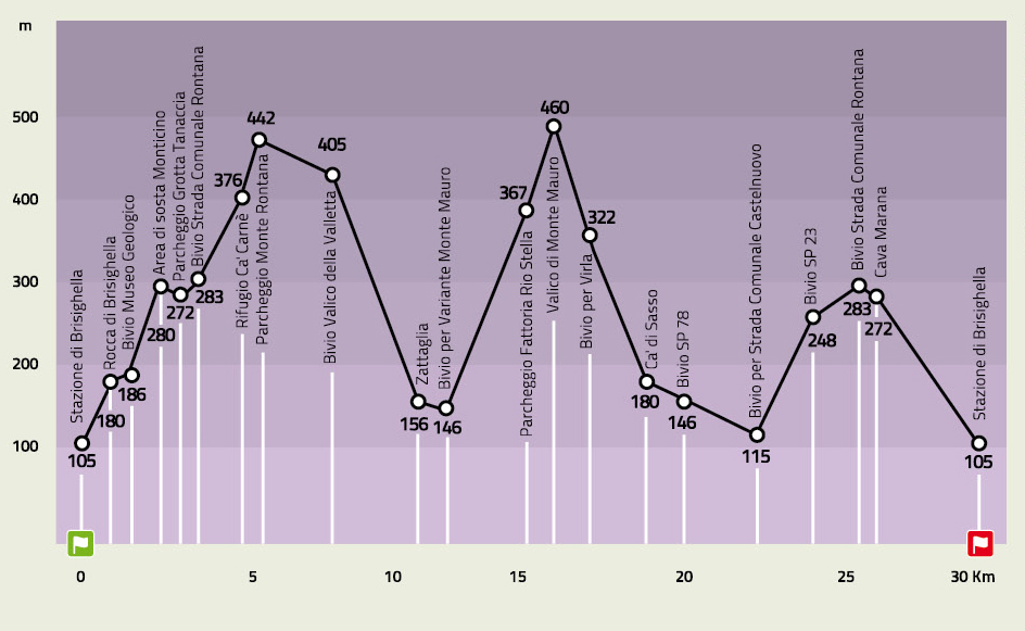
ELEVATION PROFILE
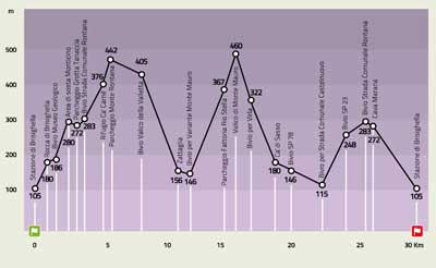
Download the elevation profile (JPEG - 209,6 KB)
CARTOGRAPHY
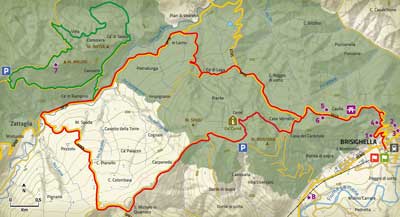
Download the map of the route (JPEG - 1,6 MB)