Ciclovia del Parco dei Sassi
Sassi di Roccamalatina Regional Park
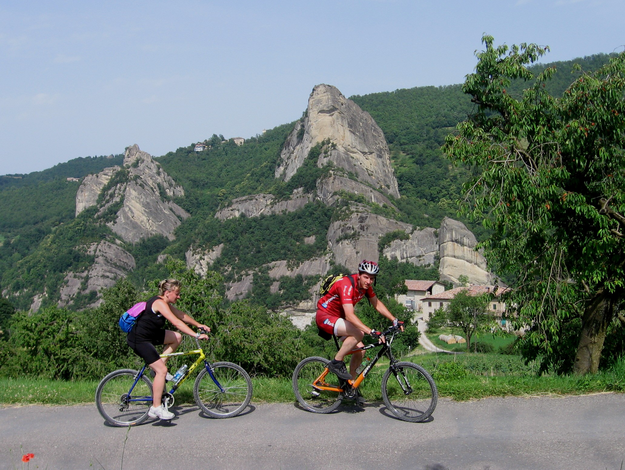
This route requires considerable effort, due to both its length and gradient, but it may be shortened a little in case of need. Everything revolves around the Sassi, sandstone pinnacles emerging in the landscape and almost always visible in the centre of our ring route. Curiously similar to the Greek Meteora, besides their geomorphological value, the Sassi hold several flora and fauna peculiarities: just to mention the wallcreeper, the rare cave salamander found in some natural cavities, or birds of prey nesting on the rocks, like the peregrine falcon. Another must is a visit to the Pieve di Trebbio, near the park visitor centre “The Fontanazzo”. The little church retains the Romanesque structure and several original stone sculptural elements, despite the heavy restoration of the early 1900s.
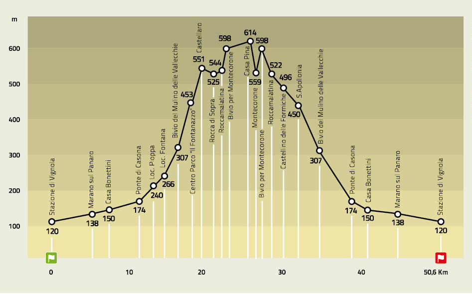
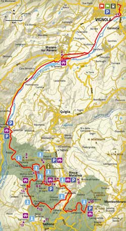
From the Vignola railway station you reach the boundaries of the park by riding along the Nature Trail of the Panaro valley bottom. After crossing Ponte Casona you take the road of the same name until the unmistakable fork at 307 m of altitude, from where you climb up several switch-backs up to Pieve di Trebbio.
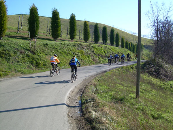
You’ll then arrive in Castellaro and Borgo dei Sassi, dominated by the sandstone pinnacles that are the heart and main attraction of the park. After the optional climb to the highest of them, you go back to the junction of Castellaro in order to reach, on asphalt, the village of Roccamalatina. From here you have two options. You can climb to Montecorone, another medieval hamlet nestled among chestnut trees and fields in view of the Sasso di Sant’Andrea. Alternatively, you can immediately start the circumnavigation of the valley of Mulino della Riva, by following the winding road that reaches Castellino delle Formiche and a panoramic view towards the Sassi.
From here, passing through Sant’Apollonia, you ride downhill to the fork at 307 m of altitude you already touched on the first leg, and you return to Vignola.
ELEVATION PROFILE
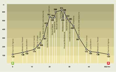
Download the elevation profile (JPEG - 214,1 KB)
CARTOGRAPHY
Download the map of the route (JPEG - 2,0 MB)