The cartography of the Alta Via dei Parchi
High resolution map of the Alta Via dei Parchi itinerary + GPS tracks of the single stages or of the whole itinerary.
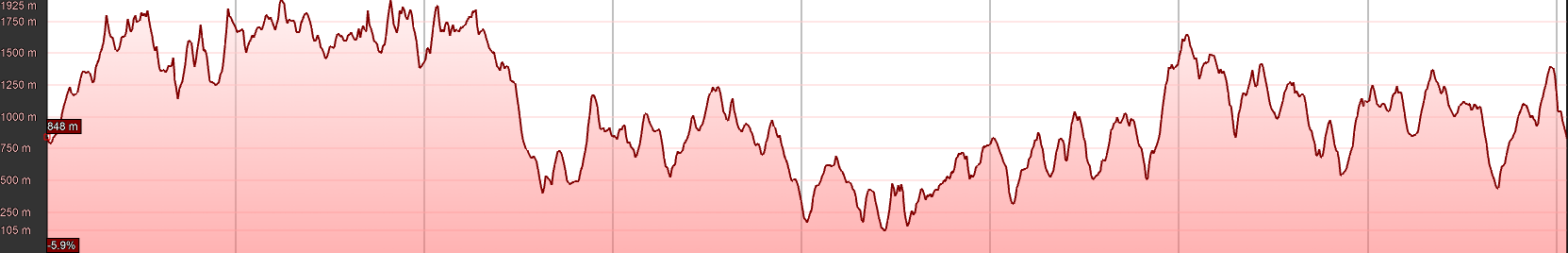
The itinerary develops for a total of about 500 km, with an elevation gain > 30'000 meters.
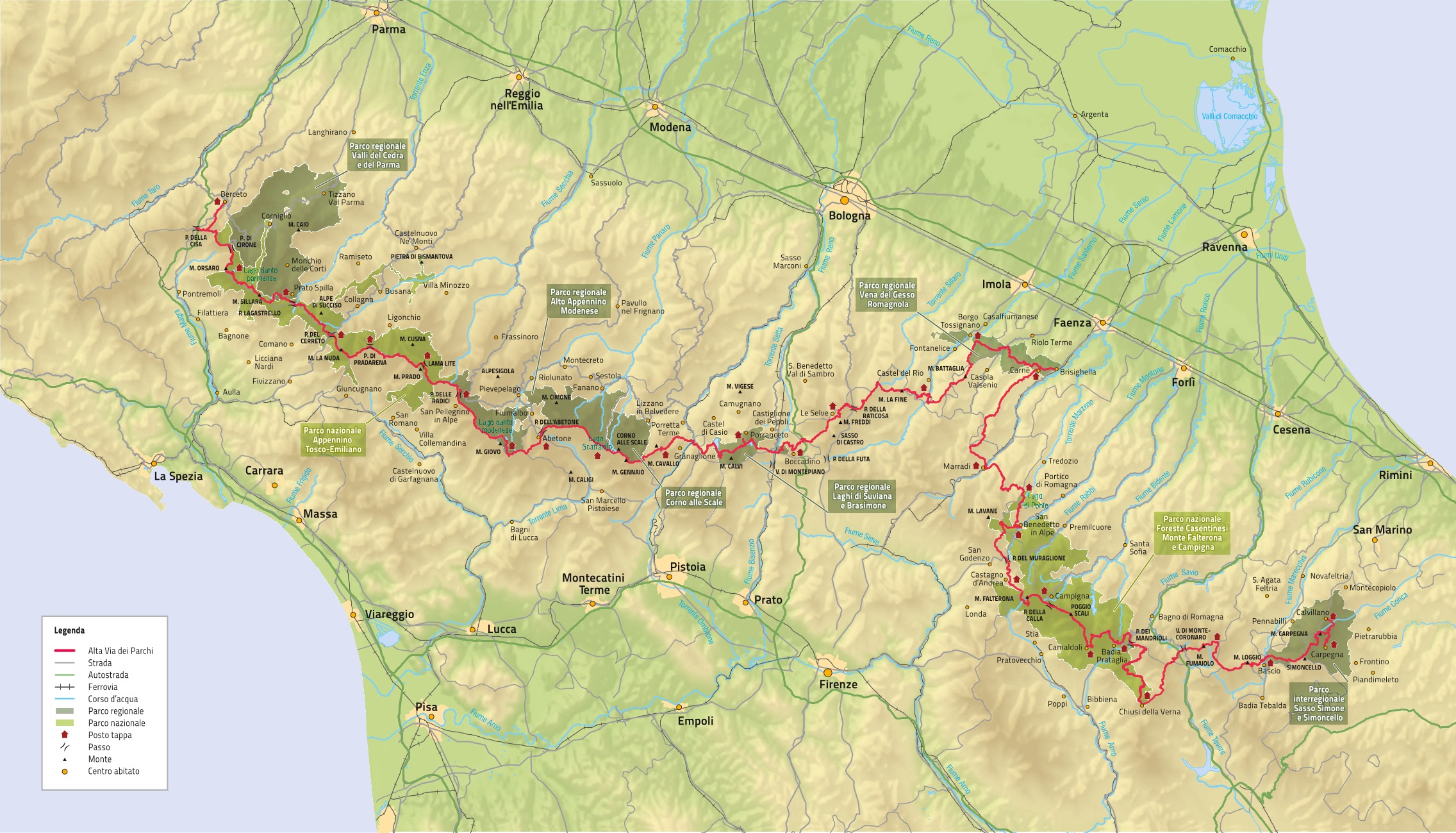
On the high-resolution map of the Alta Via dei Parchi (PNG - 7,9 MB) itinerary, you can see the whole development of the AVP route, the 27 stop-over points and the Parks crossed by the itinerary.
For those who have a GPS navigator, a Smartphone with App compatible with the GPX format and/or for those who simply want to visualize the itinerary of the AVP on Google Earth, it is also possible to download the GPX files of the single stages or, if you prefer, to download the GPX file of the whole route ( - 2,6 MB).
For those who wish to learn more about each single stage, on the dedicated page you can find a description of the itinerary, some photos, the single track, the local cartography and the altimetric profiles (obtained from Google Earth). At the bottom of the page you will also find the section "download-itinerary-and-points-of-interest", where you will find a deepening for the visualization on Google Earth of the track and of the relative Points of Interest (accommodations with relative addresses, water points, transport logistics, etc.).
You can also visualize the Alta Via dei Parchi on the regional cartographic portal (Moka), in the WebGIS dedicated to the Alta Via and to the Ciclovie dei Parchi, as well as in the WebGIS dedicated to the REER - "Rete Escursionistica Emilia-Romagna" (Emilia-Romagna Hiking Network), in which you will find all the almost 6'000 km of trails in the region.
Finally, you can not only visualize the itinerary of the Alta Via dei Parchi and the relative Points of Interest, but you can also be guided along the entire route through the App "Maps4You" of the Emilia-Romagna Region. Once you have installed the App (available for Android and Apple systems), you will need to go to the "Culture and Tourism" Section - Subsection "Alta Via e Ciclovie dei Parchi".
Printed Version Maps
Please refer to the "Publications" section for the cartographic versions of the maps and AVP route guide.