
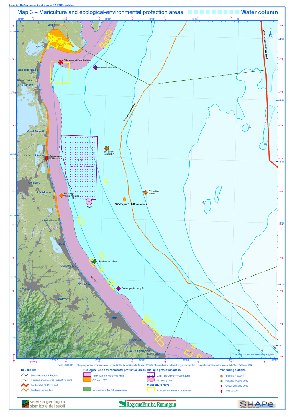
Map 3 –Mariculture and ecological-environmental protection areas –Water column
Map 3 –Mariculture and ecological-environmental protection areas –Water column


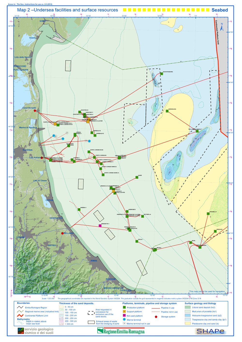
Map 2 –Undersea infrastructures and surface resources - Seabed

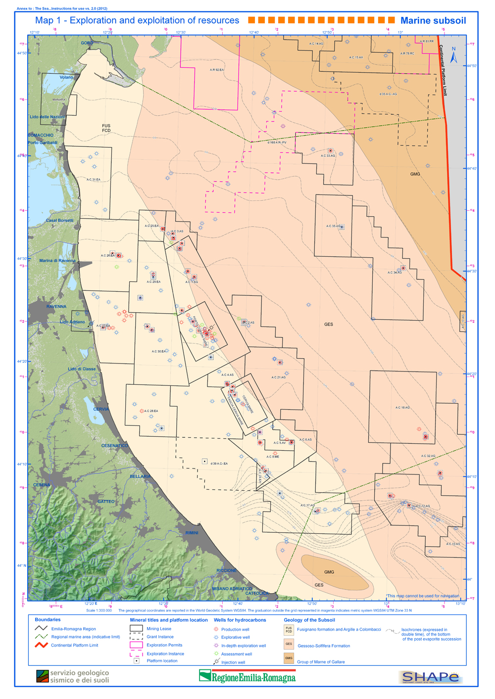
Map 1 –Exploration and exploitation of the resources – Marine subsoil
Photos of landscape types in Emilia-Romagna slides show
map in scale 1:25 000

Volume of "Illustartive Notes" and "Stratigraphic Tables" + Geological Cross Sections + Structural-Geological Map of the Emilia-Romagna Apennines in scale 1:250,000 (italian and english languages)

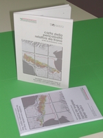
Volume 109 pages + Landslide susceptibility map of the Emilia-Romagna Region, Italy, in scale 1:250.000, italian and english languages