Tha CARG project - Geological map of Italy, scale 1:50.000
Launched in 1988 with the purpose of compiling the new geological map of Italy to scale 1:50.000 and updating the Geological Map of Italy to scale 1:100.000 (completed in 1976), the CARG National Project is the result of developments and advances in the field of Earth Sciences and of the need for up-to-date documentation at a larger scale containing far more detailed information. The new geological map to scale 1:50.000, a valuable tool for knowledge and valorization of the territory and its resources, has also enabled more appropriate territorial planning intended to mitigate natural risks, first and foremost hydrogeological risks.
The task of compiling the geological map of Italy to scale 1:50.000 was entrusted to the Geological, Seismic and Soil Survey, and subsequently to ISPRA (Italian Institute for reasearch and for the Environment Protection) which is currently in charge of the Project. The CARG project also involves the digitization of geological cartography and related geological data. The guidelines which ensure a uniform national approach in terms of content and representation, defining standards for surveying, preparation of sheets and illustrative notes.
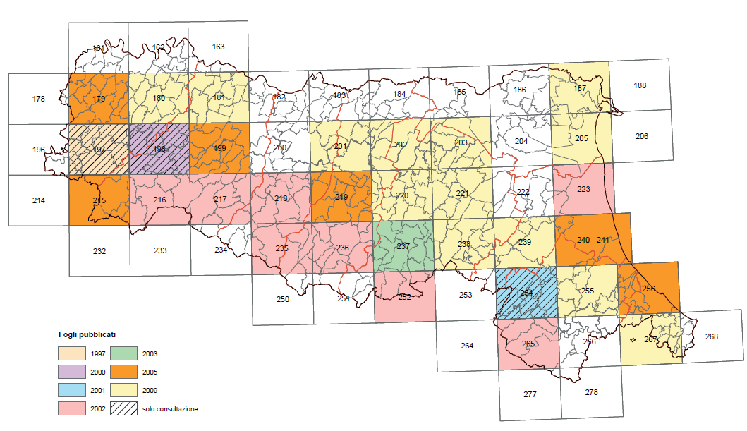
Regione Emilia-Romagna, which has been working on the National Project since 1992 with the active participation of the staff of the Geological, Seismic and Soil Survey, has to date published 28 geological Sheets to scale 1:50.000, and is nearing coverage of the entire region, both mountain and plain. The geological sheets have been produced in consultation with university lecturers and researchers, researchers of the Italian national research council and geologists who performed the surveying for the basic cartography.
The Istituto Poligrafico dello Stato (the official publication body of the Italian government) printed three Sheets (197-Bobbio; 198-Bardi; 254-Modigliana), the Geological, Seismic and Soil Survey helped print a number of the remaining sheets. The Sheets published to date can be purchased from the regional Cartographic Archive.
- Webgis on geological cartography
An interactive website offering access to the geological and geothematic maps of Emilia-Romagna region (italian language). 161.73 KB)
 - Mapshop of Emilia-Romagna
 161.73 KB)